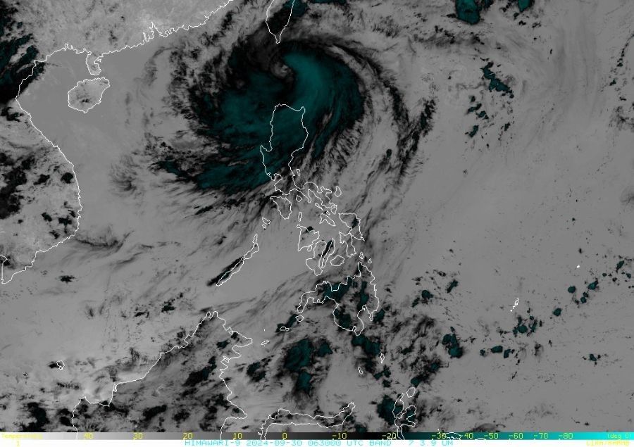
'Julian' leaves Batanes, approaches PAR's northwestern limit
MANILA, Philippines — Typhoon Julian (international name: Krathon) is now departing from Batanes after unleashing torrential rains and strong winds in Northern Luzon, according to the state weather bureau PAGASA.
As of 5 p.m. on Monday, September 30, PAGASA reported that Julian is moving toward the northwestern boundary of the Philippine Area of Responsibility (PAR).
The peak winds of the Julian, however, will continue to affect areas under Wind Signal No. 4. until early evening.
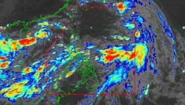
According to the latest bulletin, the eye of Julian was located 95 kilometers west southwest of Itbayat, Batanes, with maximum sustained winds of 175 kilometers per hour (kph) near the center and gustiness reaching up to 215 kph.
The typhoon is projected to move west northwestward at a speed of 15 kph.
Areas under cyclone warning
PAGASA raised the following Tropical Cyclone Wind Signals (TCWS):
Signal No. 4, typhoon-force winds: Batanes
Signal No. 3, storm-force winds: The northern and western portions of Babuyan Islands
Signal No. 2, gale-force winds: The northern and western portion of Mainland Cagayan, including the rest of Babuyan Islands, Apayao, Abra, Kalinga, Ilocos Norte, and the northern and central portions of Ilocos Sur
Signal No. 1, strong winds: Ilocos Sur, La Union, Pangasinan, Ifugao, Mountain Province, Benguet, the rest of Mainland Cagayan (Peñablanca, Tuguegarao City, Enrile), Isabela, Nueva Vizcaya, Quirino, the northern portion of Aurora, and the northern portion of Nueva Ecija.
PAGASA advises residents in these provinces to stay in designated evacuation centers or sturdy buildings, avoiding riverbanks and coastal areas to reduce the risk of flooding and storm surges.
There is also a moderate to high risk of life-threatening storm surge in the next two days along the coastal localities of Batanes, Cagayan and Ilocos Norte, the state weather bureau warns.
As the wind flow moves toward the circulation of Julian, PAGASA said that strong to gale-force gusts may be expected in the following areas on October 1:
- Ilocos Region
- Cordillera Administrative Region
- Northern and eastern portions of mainland Cagayan
- Easter portion of Isabela
- Aurora
- Zambales
- Bataan
- Metro Manila
- CALABARZON
- Romblon
- Camarines Norte
- Camarines Sur
- Catanduanes
Forecast track
PAGASA anticipates that Typhoon Julian will recurve by Tuesday, October 1, and move northeastward on October 2 towards the southwestern coast of Taiwan.
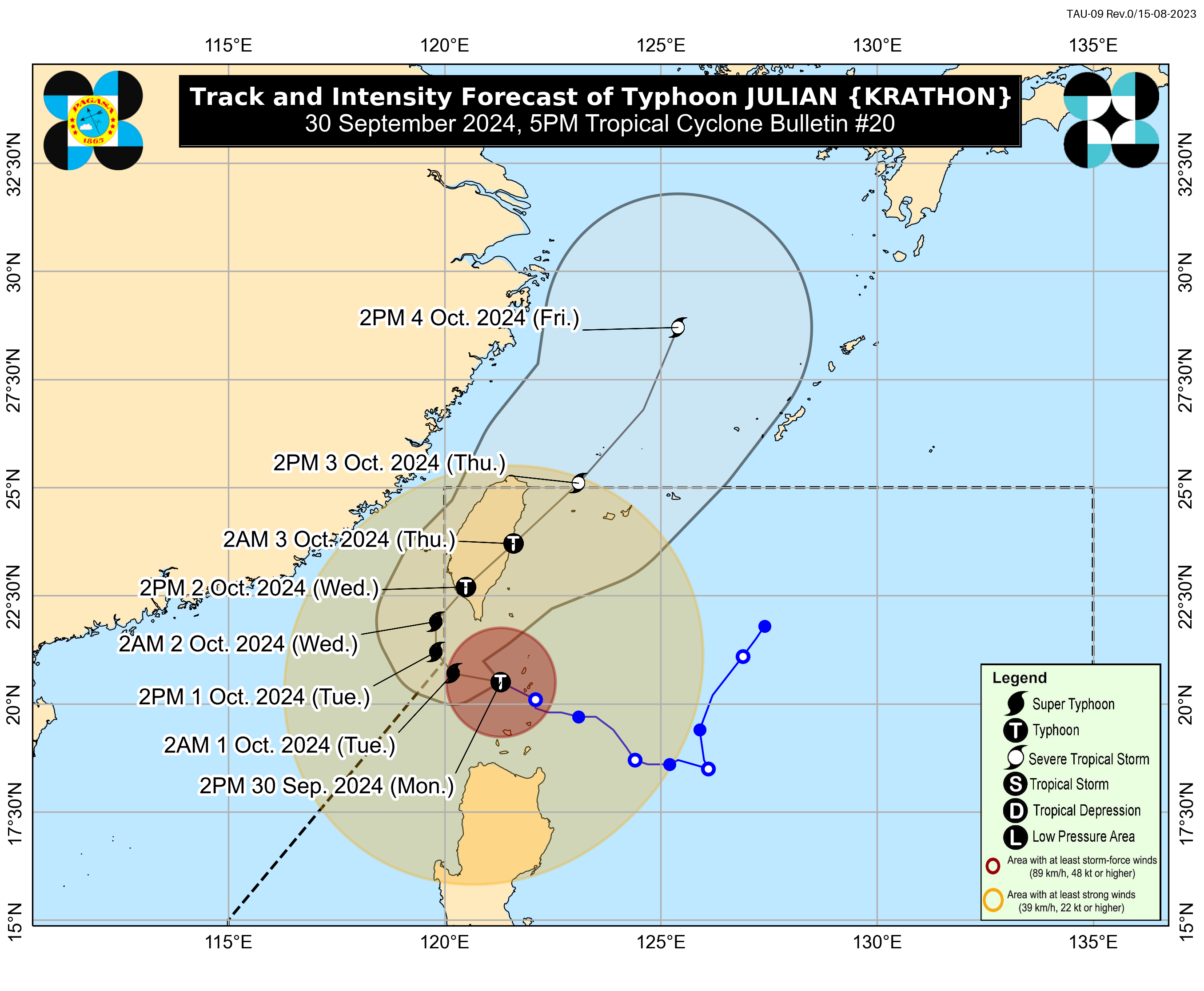
The state weather bureau also said that Julian is expected to continue intensifying and may likely become a super typhoon this evening.


- Latest
- Trending