'Julian' batters northernmost Philippines, threatens Taiwan
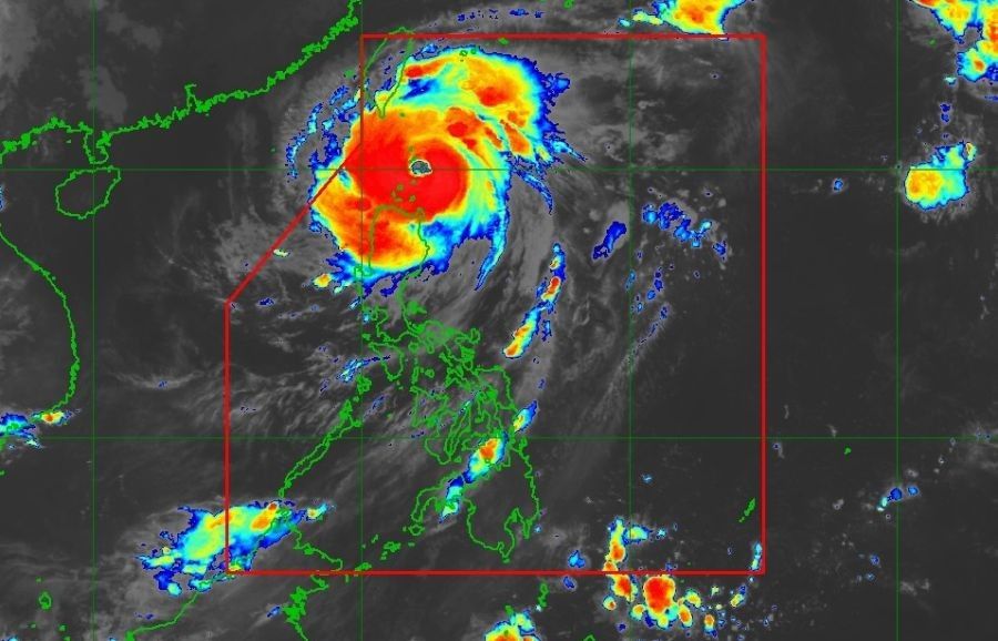
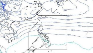
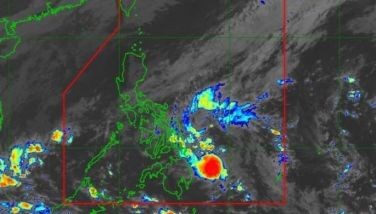
MANILA, Philippines — Typhoon Julian (international name Krathon) continued to intensify early Monday, September 30 as it moves over the Balintang Channel, bringing violent winds and heavy rainfall to parts of Northern Luzon.
As of 4 a.m. today, the eye of the typhoon was located over the coastal waters of Balintang Island, Calayan, Cagayan, according to state bureau PAGASA's weather advisory
Julian is currently packing maximum sustained winds of 155 kilometers per hour (kph) near the center, with gustiness of up to 190 kph. The typhoon is moving westward at a speed of 10 kph, with its strong to typhoon-force winds extending up to 560 km from the center.
Areas under cyclone warning
PAGASA has raised the following Tropical Cyclone Wind Signals (TCWS):
- Signal No. 4, typhoon-force winds: Batanes and the northern portion of Babuyan Islands
- Signal No. 3, storm-force winds: The rest of Babuyan Islands and northeastern portion of mainland Cagayan
- Signal No. 2, gale-force winds: The rest of mainland Cagayan, Apayao and Ilocos Norte
- Signal No. 1, strong winds: Ilocos Sur, La Union, Pangasinan, Abra, Kalinga, Ifugao, Mountain Province, Benguet, Isabela, Nueva Vizcaya, Quirino, Aurora, the northern and eastern portions of Nueva Ecija (Cuyapo, Rizal, Laur, Pantabangan, Science City of Muñoz, Gabaldon, Carranglan, San Jose City, Lupao, Talugtug, Bongabon, Llanera, Talavera, Palayan City, General Mamerto Natividad), and Polillo Islands
Winds. The peak of devastating typhoon-force winds is expected to be felt over areas under Signal No. 4 between Monday morning and afternoon. Significant to severe impacts from these winds are possible in these areas.
Rainfall. Heavy rainfall is expected in affected areas. Residents are advised to refer to Weather Advisory No. 16 for detailed information on the heavy rainfall outlook.
Storm surge. A moderate to high risk of life-threatening storm surge is expected in the next 48 hours over low-lying or exposed coastal localities of Batanes, Babuyan Islands, and northern mainland Cagayan.
Maritime conditions. Very high seas of up to 14.0 meters are expected over the seaboards of Batanes, and up to 10.0 meters over the seaboards of Babuyan Islands. Sea travel is considered risky for all types of vessels in these areas.
Forecast track
Julian is expected to move west-northwestward over the Balintang Channel today, passing very close to Balintang Island and Batanes. The typhoon is forecast to begin recurving tomorrow, October 1, and then turn generally northeastward on Wednesday, October 2, towards the southwestern coast of Taiwan.
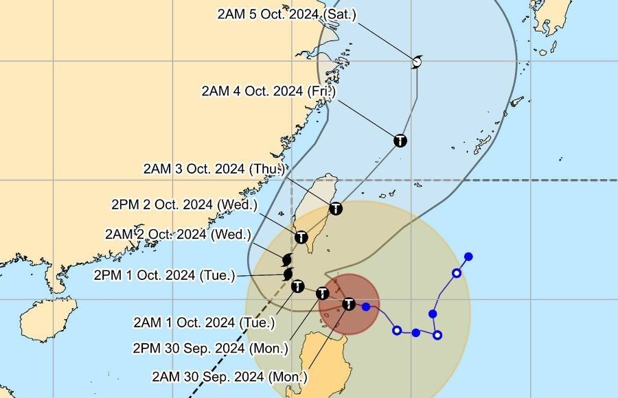
PAGASA warns that Julian may reach super typhoon category tomorrow at the start of the recurving movement. The public and disaster risk reduction and management offices are advised to take all necessary measures to protect life and property.


- Latest
- Trending