Signal No. 3 up over Batanes, Babuyan Islands as 'Leon' strengthens

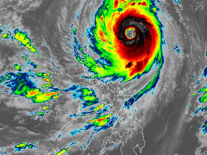
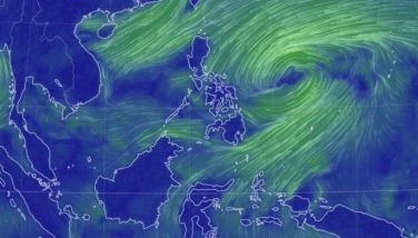
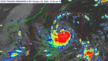
MANILA, Philippines — Signal No. 3 has been raised over Batanes and the eastern portion of Babuyan Islands as Typhoon Leon continued to intensify in the Philippine Sea.
As of 4 a.m. on Thursday, October 30, PAGASA said that Leo was found 395 kilometers east of Calayan, Cagayan.
Packing peak winds of 165 kilometers per hour (kph) near the center and gustiness of up to 205 kph, Leon is now moving west-northwest at 15 kph.
Wind signals
The following areas are under tropical cyclone wind signals:
Signal No. 3
- Batanes
- eastern portion of Babuyan Islands
Winds between 89 kph to 117 kph may be expected in at least 18 hours. Residents of areas under Signal No. 3 could experience moderate to significant impacts from strong winds.
Signal No. 2
- rest of Babuyan Islands
- Cagayan
- northern and eastern portions of Isabela (Santo Tomas, Santa Maria, Quezon, San Mariano, Naguilian, Dinapigue, Delfin Albano, San Pablo, Ilagan City, Benito Soliven, Tumauini, Cabagan, Palanan, Quirino, Divilacan, Gamu, Mallig, Maconacon, Burgos, City of Cauayan, San Guillermo, Angadanan, Cabatuan, Luna, Reina Mercedes, Roxas, Aurora, San Manuel)
- Apayao
- Kalinga
- northern and eastern portions of Abra (Tineg, Lacub, Malibcong, Lagayan, San Juan, Lagangilang, Licuan-Baay, Daguioman)
- eastern portion of Mountain Province (Paracelis)
- Ilocos Norte
Residents of areas under Signal No. 2 could experience minor to moderate impacts from strong winds, with winds between 62 kph and 88 kph expected within at least 24 hours.
Signal No. 1
- rest of Isabela
- Quirino
- Nueva Vizcaya
- rest of Mountain Province
- Ifugao
- Benguet
- rest of Abra
- Ilocos Sur
- La Union
- Pangasinan
- Nueva Ecija
- Aurora
- northeastern portion of Tarlac (Camiling, San Clemente, Paniqui, Moncada, Anao, San Manuel, Pura, Ramos, Victoria, Gerona, Santa Ignacia, City of Tarlac, La Paz)
- northern portion of Bulacan (Doña Remedios Trinidad, San Miguel)
- northern portion of Quezon (Infanta, General Nakar) including Polillo Islands
- Camarines Norte
- northern portion of Camarines Sur (Siruma, Tinambac, Lagonoy, Garchitorena, Caramoan)
- northern and eastern portions of Catanduanes (Pandan, Gigmoto, Bagamanoc, Panganiban, Viga, Baras, Caramoran)
Residents of areas under Signal No. 1 could experience minimal to minor impacts from strong winds, ranging from 39 to 61 kph.
Severe winds
PAGASA said that Signal No. 4 may be over Batanes and the Babuyan Islands, with the possibility of Signal No. 5 as well.
Gusty conditions are expected in the following areas due to Typhoon Leon:
- Wednesday, October 30: Bataan, Metro Manila, CALABARZON, MIMAROPA, Bicol Region, most of Visayas and Dinagat Islands
- Thursday, October 31: Aurora, Batangas, Quezon, MIMAROPA and Bicol Region
- Friday, November 1: Batanes, Cagayan, Isabela and Aurora
Storm surge, sea conditions
The state weather bureau warned of dangerous storm surges of 2.0 to 3.0 meters in low-lying coastal areas of Batanes, Cagayan and the Babuyan Islands. This warning is in effect for the next 48 hours.
A gale warning has been raised over Northern Luzon and the eastern seaboards of Central and Southern Luzon due to strong winds and rough sea conditions brought by Typhoon Leon.
PAGASA advised mariners of dangerous sea conditions, warning that travel poses risks for smaller vessels, such as motorbancas, in the following areas:
Up to 12 meters: The seaboards of Batanes
- Up to 10 meters: Babuyan Islands and northeastern Cagayan
- Up to 8 meters: Remaining eastern seaboard of mainland Cagayan
- Up to 7 meters: Isabela and the remaining northern seaboard of mainland Cagayan
- Up to 6 meters: Northern Ilocos Norte
- Up to 4.5 meters: Northern Aurora, Western Ilocos Norte, Aurora, Polillo Islands, Camarines Norte, northern Camarines Sur and Catanduanes
- Up to 3.5 meters: Ilocos Sur and Northern Samar
- Up to 3 meters: Mainland Quezon, Camarines Sur, Albay, Sorsogon, Eastern Samar and other seaboards of the Ilocos Region
- Up to 2.5 meters: Zambales, Bataan, Occidental Mindoro (including Lubang Islands), Kalayaan Islands, northern Palawan and parts of Surigao del Norte and Surigao del Sur
- Up to 2 meters: Remaining seaboards of Luzon and Visayas
Track, intensity outlook
PAGASA said that Leon is expected to gain strength, nearing super typhoon status as it tracks toward Taiwan and comes close to Batanes.
Leon is forecast to track northwestward, bringing it closer to the Philippine territory, where it may make landfall along Taiwan’s eastern coast on Wednesday afternoon.
It is anticipated to turn north-northwest, moving over the Taiwan Strait toward the East China Sea, and may exit the Philippine area of responsibility by Thursday evening or early Friday.
The typhoon is expected to pass closest to Batanes from early Wednesday until noon, with intense winds and heavy rain forecast in the area.
While a direct landfall in Batanes remains uncertain, PAGASA has advised residents in northern Luzon to prepare for severe weather impacts as Leon makes its approach.
- Latest
- Trending


