LPA now tropical depression, enters PAR today

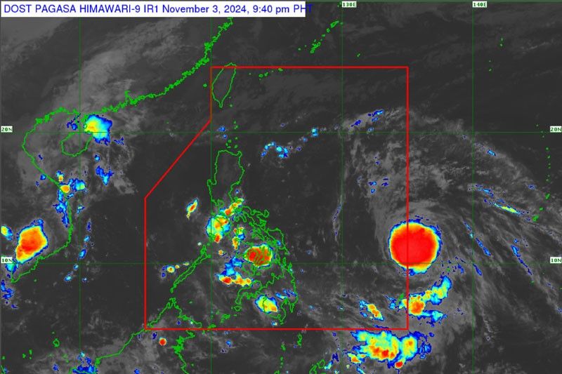
MANILA, Philippines — The low-pressure area (LPA) last monitored outside the Philippine area of responsibility has developed into a tropical depression and may enter PAR in the next 12 hours, the Philippine Atmospheric, Geophysical and Astronomical Services Administration (PAGASA) said yesterday.
PAGASA weather specialist Ana Clauren-Jorda said the tropical depression was last monitored 1,495 kilometers off Eastern Visayas at 2 p.m. yesterday.
Once the tropical depression enters PAR, it will be named “Marce” and will be the 13th tropical cyclone this year.
Clauren-Jorda said that either the tropical depression might make landfall in portions of Cagayan by Wednesday or Thursday or it will only approach Northern Luzon.
“We are currently preparing for this and will continue to monitor (the movement of the tropical depression),” she added.
Defense Secretary and National Disaster Risk Reduction and Management Council (NDRRMC) chairman Gilberto Teodoro Jr. convened with government agencies yesterday to ensure that adequate support for preparedness and response operations are available.
The NDRRMC urged all citizens to stay informed and heed official advisories as the situation develops.
PAGASA said the easterlies or warm wind from the Pacific Ocean are currently affecting the eastern portion of Luzon and Visayas bringing isolated rains.
“In the next days, possibly Tuesday onwards, there is a high chance of rains in the eastern portion of Luzon, especially the mainland Cagayan due to the shear line. We are advising affected residents on the possibility of flooding and landslide,” she added.
Yesterday, easterlies affected Batanes and Babuyan Islands, Bicol region, Eastern Visayas, Aurora, Quezon and the rest of Cagayan Valley, while isolated rains were experienced in Metro Manila and the rest of the country due to localized thunderstorms. — Pia Lee-Brago
- Latest
- Trending


