Storm 'Marce' gains strength off Bicol, seen to intensify rapidly

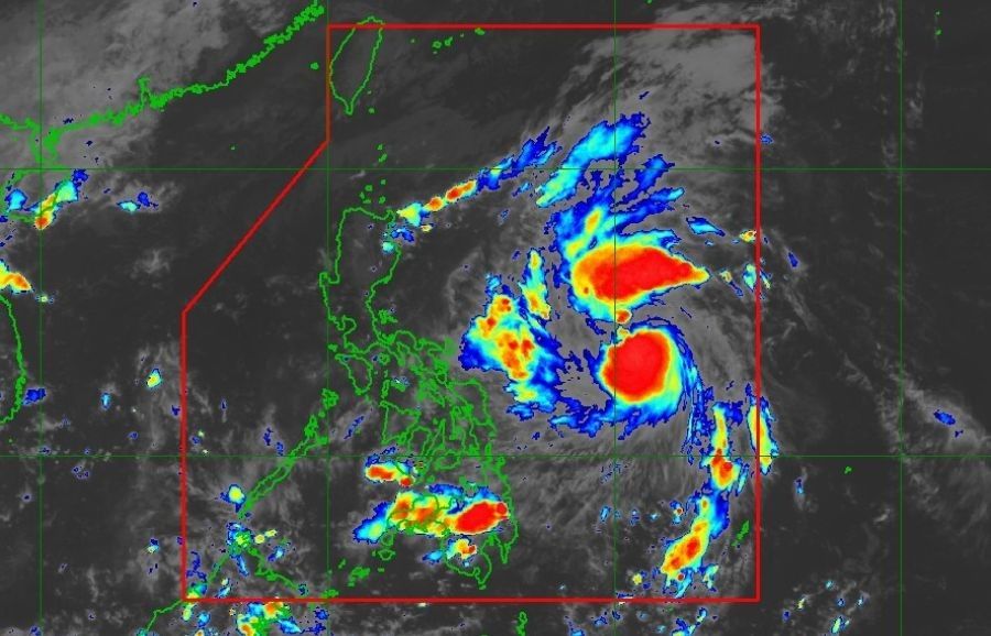
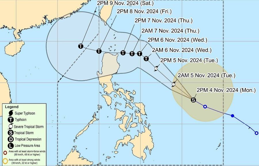
MANILA, Philippines — Tropical Storm Marce (international name Yinxing) has further intensified over the Philippine Sea east of Bicol Region on Monday afternoon and is expected to reach typhoon category by Tuesday evening, November 5 or early Wednesday morning.
As of 4 p.m., state weather bureau PAGASA located Marce 740 kilometers east of Virac, Catanduanes, packing maximum sustained winds of 85 kilometers per hour (kph) and gustiness of up to 105 kph. The storm is moving west-northwestward at 30 kph.
Possible landfall. PAGASA forecasts that Marce will make landfall in the vicinity of Babuyan Islands or mainland northern Cagayan between Thursday evening and early Friday morning.

However, due to uncertainty in the strength of the high-pressure area north of Marce, the landfall point may shift to the mainland Cagayan-Isabela area.
The bureau warns that rapid intensification is likely, with Marce expected to reach severe tropical storm category by Monday night or Tuesday morning, and possibly intensifying into a typhoon by Tuesday evening or early Wednesday.
Wind signals, impact
While no tropical cyclone wind signals are currently in effect, PAGASA may raise Signal No. 1 over portions of Cagayan by Monday night or Tuesday morning.
The agency notes that Signal No. 4 could be the highest wind signal to be hoisted during Marce's sweep within the Philippine area of responsibility.
Strong to gale-force winds are expected over Batanes, Cagayan including Babuyan Islands, Isabela, Ilocos Norte, Aurora, and the northern portion of Quezon.
The storm's trough and enhanced northeasterly wind flow will bring rains over Extreme Northern Luzon and the eastern section of Luzon beginning Monday or Tuesday.
Maritime conditions. Rough seas with waves up to 3.5 meters are expected over the seaboard of Batanes, while waves up to 3.0 meters may affect the seaboards of Babuyan Islands, Ilocos Norte, Ilocos Sur, Isabela, northern Aurora, and the eastern seaboard of mainland Cagayan.
Small seacraft operators are advised not to venture out to sea in these areas.
- Latest
- Trending


