To-do list

I spent the past few days researching on the steps authorities can take to significantly reduce flooding in Metro Manila and beyond.
It’s not going to be easy and it would require a whole-of-nation approach but we must take the necessary steps so that when the next great flood comes, we are better prepared than we ever were.
The first would be a major clean-up of our creeks and waterways, ridding these passages of garbage, filth and what-have you. One doesn’t need to go around Metro Manila to see that many parts of the metropolis are teeming with all sorts of things. There’s a hodgepodge of everything that’s not supposed to be there. These, in effect, clog our canals, rivers, creeks and waterways.
Citizens must do their part in keeping our cities clean and livable. Sometimes, I would see motorists just throwing thrash out of their car windows. Is it that difficult to throw their waste in the trash can when they get home or wherever they’re heading?
But that’s just a small part of the problem. It’s really the lack of discipline on the part of Filipinos to manage waste but we must do it so that we can keep our surroundings, our communities, our cities and not just our homes livable.
Underground drainage
An engineer reader, Alex Serrano, also shared with me his proposed flood-control measures.
These include an underground drainage tunnel. Serrano also suggested specific areas where the structures can be put up.
Since boring equipment and technology are now available in our country, I hope that the MMDA in coordination with JICA will consider the feasibility of constructing underground concrete drainage structures in support of our metro-wide flood control program along the major roads of Metro Manila going toward Manila Bay as follows:
• Along Dr. A Santos Ave. exiting at the Las Piñas Parañaque Wetlands Park;
• All over the NAIA Compound directed toward Tripa de Galina then toward Manila Bay;
• Along EDSA branching out to Libertad Channel in the north and the Redemptorist Channel in the south then toward Manila Bay;
• Along Buendia Ave. toward Manila Bay;
• Along Quirino Ave. toward Manila Bay;
• Taft Ave. to Kalaw Ave. then toward Manila Bay;
• Taft Ave. to P. Burgos Ave. then toward Manila Bay.
Reservoir
He also said, “Let us try to complement the much-reduced capacity for capturing and storing water of our upland watersheds like La Mesa, Marikina, etc. by constructing a massive reservoir in the area of the Laguna Lake near the mouth of the Manggahan Floodway to be used as a water impounding reservoir big enough to catch a significant volume of the floodwaters coming from the floodway during a major storm.”
Long-term solutions
Development planning and proper land use are also among the long-term solutions.
Our authorities must put enough resources into implementing proper land use.
As the Asian Development Bank pointed out, illegal human encroachment on river corridors should be controlled through enforcement of land-use regulations. Rock and sand mining policies and plans should be based on sound scientific analysis, it said.
It is also urgent for our government to protect our watersheds.
“These measures will help intercept rainfall, delay rainfall runoff and minimize soil erosion and therefore flood severity. In a complex land-use and development scenario of a watershed, flood management is becoming more difficult, so it’s important to integrate these measures into the socio-economic development plan,” the ADB said.
Furthermore, it said that granular data is needed to support hazard assessment, development planning and monitoring in a vast number of watersheds, though obtaining this level of data is a challenge. Hydro-meteorological observations and remote sensing technologies would also be invaluable. The capacities of local governments and communities need to be enhanced to fill the gaps and promote sustainability.
“Integrated watershed management is needed. It advocates coordinated development planning at a watershed scale with collective efforts by administrations and many other stakeholders,” the multilateral agency also said.
Better weather forecasting and flood warnings are also needed so that citizens will be well aware of what to expect.
Decongesting Metro Manila
We must also decongest the capital region. Many observers and experts have long been sounding the alarm on the alarming density in Metro Manila. There must be a concerted effort to move to other business districts.
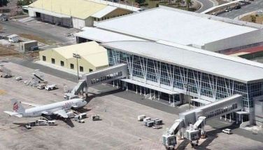
The Clark Freeport and Special Economic Zone in Pampanga is a viable option, especially with the efficient Clark International Airport or CRK and the toll roads connecting Metro Manila to the province.
CRK is operated by the Luzon International Premiere Airport Development (LIPAD) Corp. whose members include Filinvest Development Corp., JG Summit Holdings Inc., Philippine Airport Ground Support Solutions Inc. and Changi Airports Philippines (I) Pte. Ltd.
Another option is tycoon Manny Villar’s Villar City. It is less than an hour’s drive from Makati via Skyway and MCX and it really has the potential to be the next business district, especially with its proximity to Metro Manila.
There is indeed so much that needs to be done for us to be better equipped when the next great flood comes.
Most importantly, we must treat disasters not as passing occurrences or occasional disruptions but as major threats to economic growth and our full potential as a country, as a nation and as a people.
* * *
Email: eyesgonzales@gmail.com. Follow her on Twitter @eyesgonzales. Column archives at EyesWideOpen on FB.
- Latest
- Trending


