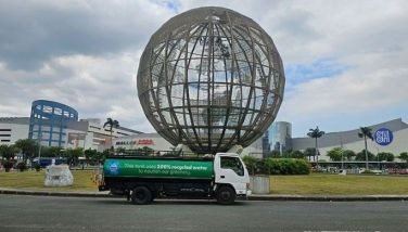
Why the roads around SM City get flooded?
Last Sunday we were in Parkmall for the birthday party of my 3rd grandchild Jenna when there was a sudden two-hour long downpour… literally it was raining cats and dogs. Thankfully, by the time we were finished in Parkmall, the rains already stopped. On our way home, we passed through SM City but then it was too late for us to turn back when traffic was at a standstill along Serging Osmeña Ave. We got stuck the longest along the bridge that spans the Subangdaku River.
Thus it afforded me the opportunity to have a close look at the raging waters that came down from the mountains of Cebu and exit towards the sea which is just 200-yards from that bridge, the official boundary between Cebu City and Mandaue City. Yes the floodwaters may have already risen, but has not overflowed and was rapidly moving out into the sea.
So looking at the roads surrounding SM City, one would wonder how come there's flooding all over SM City and yet it's a mere 500-yards to the Subangdaku River? From my view point, it's a no-brainer. The drainage from those roads surrounding SM City is either clogged or no longer working, or worse, perhaps there's even no drainage at all to start with.
Call it a coincidence that yesterday, I bumped into a good friend who once worked on the master plan for Cebu City. I will not name him for his own protection. But he merely asked me a question why wasn't there any flooding around SM City before the City of Cebu cemented those roads? Come to think of it, he is correct! Before those roads were cemented there was no flooding there. If at all there was flooding during an intense rain, it only affected the road nearest the Subangdaku River.
Then this friend of mine told me that in no uncertain terms, the road surrounding SM City was cemented without a proper drainage system factored into the cost. Hence, floodwaters do not have a place to go during a heavy downpour. This is the very reason why there is flooding today along SM City, and if Cebu City engineers do not put in at least two major drainage culverts from SM to exit out to the Subangdaku River, flooding will always be a problem in that area.
So the next question to ask is, how come there is also flooding along M.J. Cuenco Ave. along the Subangdaku River, which is quite a distance from SM City? I reckon that the root of this flooding is in the inherent design of the North Reclamation Area (NRA). Those of you who were not yet born in the 1960s won't remember that the seashore of Mabolo was just behind the Mabolo Elementary School. If you saw old aerial photos of that area, you'd notice that the Mabolo Church was so near the seashore.
So when the late Sen. Serging Osmeña, together with the Cebu Development Corp. (CDC), constructed the NRA, they made a river along what used to be the seashore spanning from the Chinese Cemetery all the way to the Subangdaku River. It was ok when the reclamation was finished. But as Cebu City grew, especially along what is now Juan Luna Ave. (formerly San Jose dela Montana), rain waters would rush into this man-made river and surge back into the street along M. J. Cuenco Ave.
This situation worsened after the old Lahug Airport was closed and Salinas Drive was connected to Juan Luna Ave. Few people remember what the old Lahug Airport looked like. It was a single runway strip surrounded by grass. So when rain water snakes down from Salinas Drive, it is blocked by the runway and settles on the grass around the runway and into the ground. But Cebu City's planning changed and soon the AsiaTown I.T Park opened and while the old runway became the Jose del Mar Ave., the surrounding area is now littered with high-rise buildings and cemented roads.
So today when the floodwaters coming from the mountains from Nivel or even from Beverly Hills cascade down from JY Square, Salinas Drive suddenly doubles as a river bringing rainwater and refuse all the way passing through AsiaTown and Juan Luna Ave. and into M.J. Cuenco Ave. That in a nutshell is the reason why there's flooding in that part of Cebu City.
Mind you, rainwater can be a blessing from God because after all, Cebu City has no huge rivers we can use for our water needs. But thanks to poor planning, that great blessing doesn't permeate back into the aquifer to replenish our underground water system, it merely pours out into the sea. So our final question is… what should we do to fix the problem?
Well, if you leave it to Mayor Michael Rama, he would sell South Road Properties (SRP) lots to fund a huge drainage project. But I dare say that is the wrong reason to sell the SRP lots. Let us first look at the master plan for the drainage and then decide how to get the funds for this project.
* * *
Email: vsbobita@gmail.com.
- Latest


