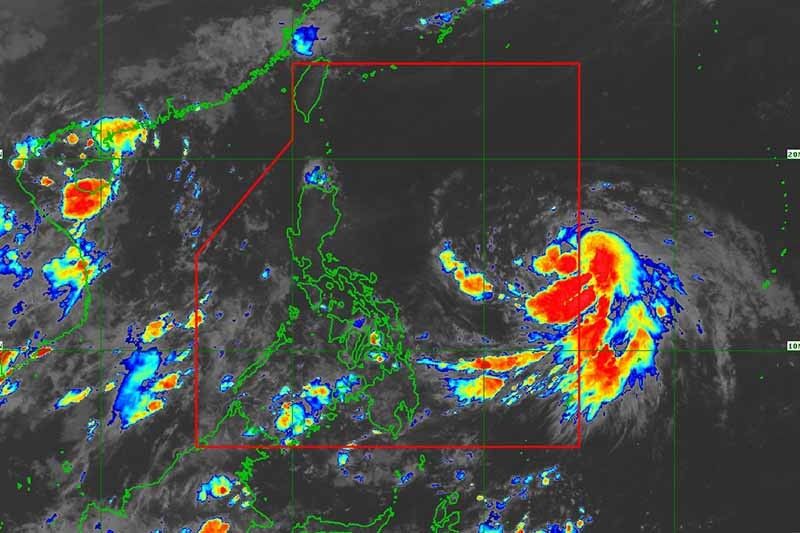
'Chedeng' intensifies further, may enhance 'habagat'

MANILA, Philippines (Updated 12:58) — Tropical Cyclone Chedeng (Guchol) kept its strength while moving over the Philippine Sea, but it is still far from the landmass and is not forecast to have direct effects on the country, PAGASA said Wednesday morning.
PAGASA said in its 11 a.m. bulletin that Chedeng was last spotted 1,090 kilometers east of southeastern Luzon, with peak winds of 75 km per hour near the center and gusts of up to 90 kph. It was heading north at 10 kph.
What to expect
State weather forecasters said that Chedeng is unlikely to directly bring heavy rain in the next three to five days because of the cyclone’s distance from the land. PAGASA might not also raise wind signals.
The tropical storm may enhance the southwest monsoon (habagat). But PAGASA noted the timing and intensity of monsoon rains as well as the likelihood of intermittent gusts may still change “because the monsoon enhancement depends on the forecast movement and intensity of Chedeng and its interaction with the other weather systems around it.”
Chedeng is also unlikely to cause rough sea conditions in the next 24 hours.
Chedeng is expected to intensify in the next three to four days, and may become a severe tropical storm Wednesday evening. It may reach typhoon category by Thursday.
Forecast position
- June 7, 2023 8:00 PM - 1,185 km east of Central Luzon
- June 8, 2023 8:00 AM - 1,090 km east of Central Luzon
- June 8, 2023 8:00 PM - 935 km east of Central Luzon
- June 9, 2023 8:00 AM - 900 km east of Northern Luzon
- June 9, 2023 8:00 PM - 865 km east of Northern Luzon
- June 10, 2023 8:00 AM - 855 km east of Northern Luzon
- June 11, 2023 8:00 AM - 900 km east of Extreme Northern Luzon
- June 12, 2023 8:00 AM - 1,165 km east northeast of Extreme Northern Luzon
— Gaea Katreena Cabico
- Latest
- Trending


