Combined effects of enhanced habagat, LPA bring rains to most parts of country

MANILA, Philippines — Weather forecasters said wet weather is expected to prevail Friday as the enhanced southwest monsoon brings rains to parts of the Philippines.
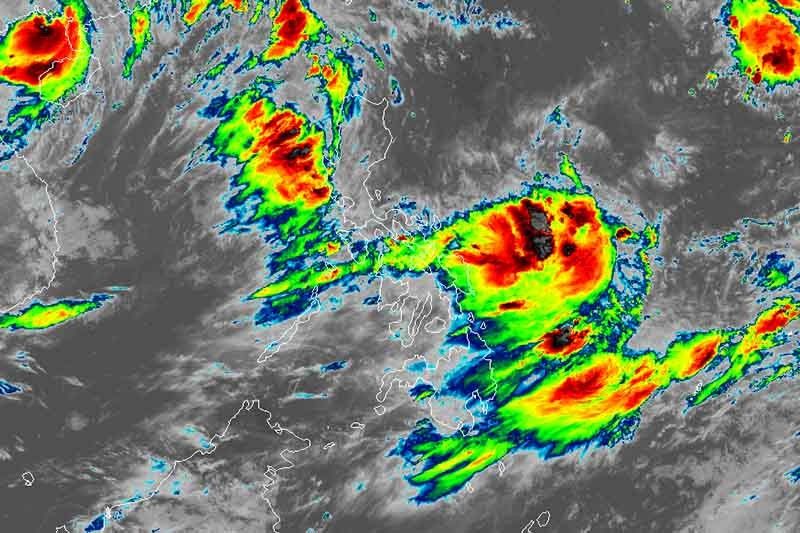
State weather bureau PAGASA said a low pressure area east of Virac, Catanduanes and tropical storm Wipha—which was last seen affecting the southern part of China—are strengthening the southwest monsoon.
The provinces of Pangasinan, Zambales and Bataan are currently experiencing monsoon rains.
Cloudy skies with scattered rainshowers and thunderstorms are affecting Metro Manila, CALABARZON, MIMAROPA, Cordillera Administrative Region, the rest of Ilocos region and the rest of Central Luzon.
At 8 a.m., PAGASA issued a “yellow warning” over Metro Manila, Zambales, Bataan and Rizal. Under the bureau’s alert system, yellow means caution where residents are advised to monitor further updates.
The heavy rainfall Friday morning flooded several areas in the metro and nearby provinces, prompting class and work suspension.
Meanwhile, the trough or the extension of the LPA will affect Bicol region, Visayas, CARAGA and northern Mindanao. Cloudy skies with scattered rainshowers and thunderstorms will be experienced in these areas.
The rest of the country will have partly cloudy to cloudy skies with isolated rainshowers.
‘LPA might intensify into tropical cyclone’
PAGASA said the LPA—which was last seen 915 kilometers east of Virac, Catanduanes—may develop into a tropical cyclone as it moves away from the country in the succeeding days.
Once it becomes a tropical cyclone, the weather disturbance is not seen to hit any part of the Philippine landmass because of its interaction with “Wipha.”
But there may be changes in scenario once “Wipha” dissipates, the weather bureau said.
- Latest
- Trending


