'Aghon' palabas na ng PAR, pero maiimpluwensyahan pag-ulan sa 3 lugar
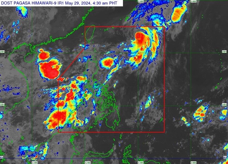
MANILA, Philippines — Napanatili ng Typhoon Aghon ang lakas nito habang kumikilos pahilagangsilangan, ayon sa pinakahuling taya ng PAGASA ngayong Miyerkules nang umaga.
Bandang 4 a.m. nang maobserbahan ang sentro ng bagyo 870 kilometro silangan hilagangsilangan ng Extreme Northern Luzon.
- Lakas ng hangin: 130 kilometro kada oras malapit sa gitna
- Bugso ng hangin: hanggang 160 kilometro kada oras
- Pagkilos: 40 kilometro kada oras
- Direksyon: pahilagangsilangan
"On the track forecast, Typhoon AGHON will move generally northeastward over the Philippine Sea for the entirety of the forecast period and exit the Philippine Area of Responsibility (PAR) this morning or afternoon," ayon sa state weather bureau.
"AGHON is forecast to enter a period of weakening by tomorrow as it begins to interact with the mid-latitude environment and undergo post-tropical transition."
Malabo nang direktang magdala ng matinding pag-ulan ang Typhoon Aghon sa Pilipinas sa susunod na tatlong araw. Gayunpaman, maaapektuhan nito ang iba pang weather system sa pagpapasungit ng panahon.
Bahagyang maiimpluwensyahan pa rin kasi ng bagyo ang Southwesterly Windflow sa pagdadala ng katamtaman hanggang malalakas na pag-ulan sa kanlurang bahagi ng Northern Luzon, Central Luzon at MIMAROPA hanggang Miyerkules.
Magdadala rin ang naturaang windflow ng minsanang mahanging panahon sa mga sumusunod na lugar, lalo na sa mga baybaying dagat, matataas at mabubundok na lugar ngayong araw:
- Batanes
- Ilocos Region
- Zambales
- Bataan
- northern Aurora
- southern mainland Quezon
- Polillo Islands
- Palawan
- Lubang Islands
- Romblon
- Marinduque
- Camarines Norte
"The Southwesterly Windflow partly influenced by AGHON and the Frontal System will bring moderate to rough seas (1.0 to 3.0 m) over the coastal waters of Batanes," patuloy ng PAGASA.
"Mariners of motorbancas and similarly-sized vessels are advised to take precautionary measures while venturing out to sea and, if possible, avoid navigating in these conditions, especially if inexperienced or operating ill-equipped vessels."


- Latest