


Typhoon Carina gains strength; Batanes under Signal No. 2
MANILA, Philippines — Typhoon Carina (international name Gaemi) intensified on Tuesday afternoon as it moves off the northern coast of the country, enhancing heavy rains and triggering floods across Luzon.
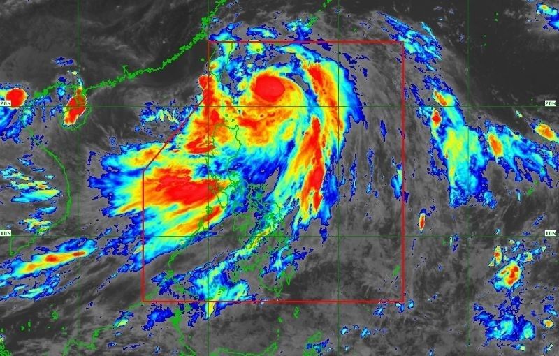
As of 4 p.m. advisory, state weather bureau PAGASA spotted the cyclone at 325 kilometers east northeast of Basco, Batanes heading northward toward Taiwan at a speed of 20 kilometers per hour (kph).
It packed maximum sustained winds of 150 kilometers per hour (kph) near the center with gustiness of up to 185 kph.
Warning signals. PAGASA has hoisted Tropical Cyclone Wind Signal No. 2 over Batanes, where gale-force winds between 62-88 kph may be expected within the next 24 hours, posing a minor to moderate threat to life and property.
Signal No. 1 is in effect over Cagayan including the Babuyan Islands, the eastern portions of Isabela (Divilacan, Palanan, Maconacon, Dinapigue, Tumauini, Ilagan City, San Mariano, Cabagan, San Pablo, Santa Maria) and Apayao (Calanasan, Luna, Pudtol, Flora, Santa Marcela, Kabugao), and the northern portion of Ilocos Norte (Pagudpud, Bangui, Adams, Dumalneg, Burgos, Vintar, Pasuquin, Bacarra, Carasi). These areas can expect strong winds of 39-61 kph within 36 hours, which may cause minimal to minor damage.
Rains. Heavy rainfall is also expected, with Batanes, the Babuyan Islands, and the northern and eastern parts of Cagayan forecast to receive 100-200 mm of rain until tomorrow afternoon.
Ilocos Norte, La Union, Abra, Benguet, Apayao, eastern Isabela, and the rest of Cagayan may get 50-100 mm of rainfall.
From tomorrow afternoon until Thursday afternoon, Batanes is predicted to receive another 100-200 mm of rain, while the Babuyan Islands may get an additional 50-100 mm. Under these conditions, flooding and rain-induced landslides are possible, especially in high-risk areas.
The enhanced southwest monsoon will also dump moderate to intense rains over western Luzon in the coming days.
Movement and exit. Carina is forecast to continue moving north-northwestward tonight while accelerating, before turning northwestward on Wednesday. It is expected to make landfall over northern Taiwan between Wednesday evening and Thursday morning, then exit the Philippine Area of Responsibility hours later.
The typhoon is seen to steadily intensify as it approaches Taiwan, with rapid intensification still possible, before weakening upon its landfall there.
Other warnings. Gale warnings are in effect over the coastal waters of Batanes, Babuyan Islands, and northeastern Cagayan, making sea travel risky for small vessels.


- Latest
- Trending


