More Luzon areas under Signal No. 2 as 'Nika' nears typhoon category
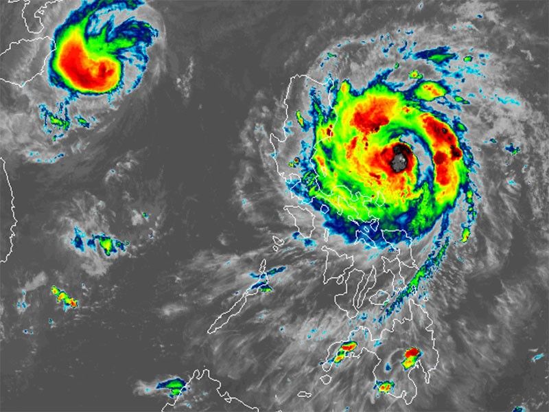
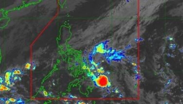
MANILA, Philippines — Severe Tropical Storm Nika (international name: Toraji) has continued to intensify and is expected to reach typhoon strength before making landfall in the coming hours.
As of 4 p.m. on Sunday, November 10, PAGASA said Nika was located 380 kilometers east of Infanta, Quezon.
Moving westward at 20 kilometers per hour, Nika is carrying peak winds of 110 kph and gusts reaching up to 135 kph.
Wind signals
The state weather bureau has raised tropical cyclone wind signals over the following areas in Luzon:
Signal No. 2
- northern portion of Aurora (Dilasag, Casiguran, Dinalungan, Dipaculao, Maria Aurora, Baler)
- Isabela
- Quirino
- southern portion of mainland Cagayan (Solana, Iguig, Peñablanca, Tuguegarao City, Enrile, Baggao, Alcala, Amulung, Santo Niño, Rizal, Piat, Tuao, Gattaran, Lasam)
- Nueva Vizcaya
- southern portion of Apayao (Kabugao, Conner, Flora, Pudtol)
- Abra
- Kalinga
- Mountain Province
- Ifugao
- Benguet
- northern portion of Nueva Ecija (Carranglan, Pantabangan, Lupao, San Jose City)
- southern portion of Ilocos Sur (Narvacan, Nagbukel, Cervantes, Quirino, San Emilio, Santa Maria, Burgos, San Esteban, Santiago, Lidlidda, Banayoyo, City of Candon, Galimuyod, Salcedo, Gregorio del Pilar, Sigay, Santa Lucia, Santa Cruz, Suyo, Alilem, Tagudin, Sugpon)
- La Union
- northeastern portion of Pangasinan (San Nicolas, Natividad, San Quintin, Sison, San Manuel, Umingan, Tayug)
Gale-force winds, ranging from 62 kph to 88 kph, could potentially cause minor to moderate impacts in these areas.
Signal No. 1
- rest of Cagayan including Babuyan Islands
- rest of Apayao
- Ilocos Norte
- rest of Ilocos Sur
- rest of Pangasinan
- rest of Aurora
- Tarlac
- northern and central portions of Zambales (Santa Cruz, Candelaria, Masinloc, Palauig, Iba, Botolan, Cabangan, San Marcelino, San Felipe, San Narciso)
- rest of Nueva Ecija
- Pampanga
- Bulacan
- Metro Manila
- Rizal
- eastern portion of Laguna (Santa Maria, Mabitac, Pakil, Pangil, Famy, Siniloan, Paete, Kalayaan, Cavinti, Lumban, Luisiana, Santa Cruz, Magdalena, Pagsanjan, Majayjay, Liliw, Nagcarlan, Pila, Victoria)
- eastern portion of Quezon (Calauag, Guinayangan, Tagkawayan, Pitogo, San Andres, Buenavista, San Francisco, Pagbilao, Infanta, Lopez, Catanauan, Mulanay, Unisan, General Luna, Plaridel, Quezon, Alabat, Sampaloc, Padre Burgos, Macalelon, Mauban, Perez, Agdangan, Gumaca, Atimonan, Real, San Narciso, General Nakar, Lucban, City of Tayabas, Lucena City) including Polillo Islands
- Camarines Norte
- Camarines Sur
- Catanduanes
- northeastern portion of Albay (Malinao, Tiwi, Bacacay, City of Tabaco, Malilipot, Rapu-Rapu)
Areas under Signal No. 1 may experience possible minimal to minor impacts from strong winds, ranging from 39 kph to 61 kph.
Severe winds
According to PAGASA, the highest wind signal that may be hoisted is Signal No. 4.
The following areas will be under threat of strong to gale-force gusts in the coming days:
- Sunday, November 10: Batanes
- Monday, November 11: Batanes, Batangas, Marinduque, Romblon, Camarines Sur and Catanduanes
- Tuesday, November 12: Batanes and Cagayan including Babuyan Islands
Storm surge, sea conditions
PAGASA said Nika continues to intensify as it approaches landfall, increasing the risk of storm surges in several coastal areas over the next 48 hours.
It warned that low-lying coastal areas in Ilocos Norte, Ilocos Sur, La Union, Pangasinan, Cagayan (including Babuyan Islands), Isabela, Zambales, Aurora, Quezon (including Polillo Islands), Camarines Norte, Camarines Sur and Catanduanes may experience a moderate to high risk of storm surges.
A gale warning has been raised for the eastern seaboard of Luzon.
Mariners are advised to stay in port or seek shelter due to the hazardous sea conditions.
Very rough to high seas
- Up to 7 meters: Isabela, northern Aurora
- Up to 5.5 meters: Aurora, Polillo Islands and Camarines Norte
- Up to 4.5 meters: Cagayan, Camarines Sur, Catanduanes, Ilocos Norte and Ilocos Sur
Rough seas
- Up to 4 meters: Catanduanes, Cagayan, Ilocos Norte and Babuyan Islands
- Up to 3.5 meters: Batanes and Ilocos Region
- Up to 3 meters: Quezon, Catanduanes, Albay, Sorsogon, Northern Samar and Polillo Islands
Moderate seas
- Up to 2.5 meters: northern Samar
- Up to 2 meters: eastern Samar, Dinagat Islands and Kalayaan Islands
Track, intensity outlook
PAGASA said Nika is expected to make landfall over Isabela or northern Aurora by Monday morning or early afternoon.
Following landfall, the storm will traverse Luzon, weakening temporarily due to land interaction. However, it may re-intensify once it reaches the West Philippine Sea.
Nika is anticipated to exit the Philippine area of responsibility by Tuesday afternoon, November 12.
- Latest
- Trending


