Entire Metro Manila under Signal No. 1, 11 areas on Signal No. 2 due to 'Nika'
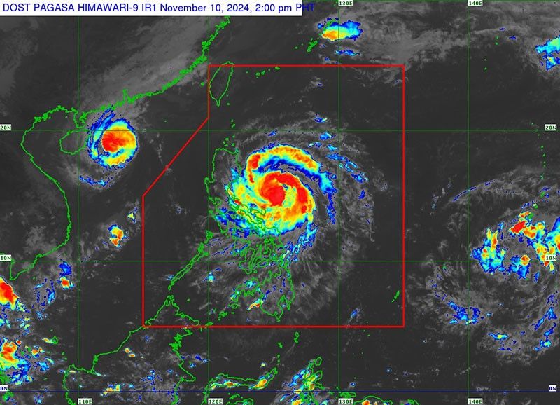
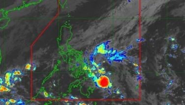
MANILA, Philippines — State weather bureau PAGASA has placed the entire Metro Manila and other Luzon areas under Tropical Cyclone Wind Signal No. 1 as Severe Tropical Storm Nika (international name: Toraji) moves westward across the Philippine Sea.
Eleven other areas, including portions of northern and central Luzon, are now under Signal No. 2 on Sunday, November 10.
In its 2 p.m. advisory, PAGASA said that Nika was located 425 kilometers east of Infanta, Quezon, carrying peak winds of 110 kilometers per hour near the center, with gusts reaching up to 135 kph.
Nika is moving westward at a speed of 30 kph, with strong winds extending outward up to 340 kilometers from the center.
Wind signals
The state weather bureau hoisted tropical cyclone wind signals over the following areas:
Signal No. 2
- northern and central portions of Aurora (Dilasag, Casiguran, Dinalungan, Dipaculao, Maria Aurora, Baler)
- Isabela
- Quirino
- southern portion of Cagayan (Solana, Iguig, Peñablanca, Tuguegarao City, Enrile)
- Nueva Vizcaya
- Kalinga
- Mountain Province
- Ifugao
- eastern portion of Benguet (Mankayan, Buguias, Kabayan, Itogon, Bokod, Atok)
- northern portion of Nueva Ecija (Carranglan, Pantabangan)
- northeastern portion of Pangasinan (San Nicolas, Natividad, San Quintin)
Residents of areas under Signal No. 2 could experience minor to moderate impacts from strong winds, with winds between 62 kph and 88 kph expected within at least 24 hours.
Signal No. 1
- rest of Cagayan including Babuyan Islands
- Apayao
- Abra
- Ilocos Norte
- Ilocos Sur
- rest of Pangasinan
- La Union
- rest of Benguet
- rest of Aurora
- Tarlac
- northern and central portions of Zambales (Santa Cruz, Candelaria, Masinloc, Palauig, Iba, Botolan, Cabangan, San Marcelino, San Felipe, San Narciso)
- rest of Nueva Ecija
- Pampanga
- Bulacan
- Metro Manila
- Rizal
- eastern portion of Laguna (Santa Maria, Mabitac, Pakil, Pangil, Famy, Siniloan, Paete, Kalayaan, Cavinti, Lumban, Luisiana, Santa Cruz, Magdalena, Pagsanjan, Majayjay, Liliw, Nagcarlan, Pila, Victoria)
- eastern portion of Quezon (Calauag, Guinayangan, Tagkawayan, Pitogo, San Andres, Buenavista, San Francisco, Pagbilao, Infanta, Lopez, Catanauan, Mulanay, Unisan, General Luna, Plaridel, Quezon, Alabat, Sampaloc, Padre Burgos, Macalelon, Mauban, Perez, Agdangan, Gumaca, Atimonan, Real, San Narciso, General Nakar, Lucban, City of Tayabas, Lucena City) including Pollilo Islands
- Camarines Norte
- Camarines Sur
- Catanduanes
- Albay (Malinao, Tiwi, Bacacay, City of Tabaco, Malilipot, Rapu-Rapu)
Strong winds ranging from 39 to 61 kph may be expected in at least 36 hours or intermittent rains may be expected within 36 hours.
Heavy rains, severe winds
PAGASA has warned of heavy rainfall due to Nika, with significant rains expected across several regions over the next few days.
Sunday until Monday noon, November 11
- Moderate to heavy rainfall (50-100 mm) expected in Aurora, Quezon, Catanduanes, Camarines Norte, Camarines Sur and Northern Samar
Monday noon until Tuesday noon, November 12
- Intense rainfall (>200 mm) in Cagayan, Isabela, Apayao, and Aurora.
- Heavy to intense rainfall (100-200 mm) in Kalinga, Mountain Province, Quirino, Nueva Vizcaya, Ifugao and Abra
- Moderate to heavy rainfall (50-100 mm) in Catanduanes, Camarines Norte, Camarines Sur, Quezon, Nueva Ecija, Benguet, Ilocos Norte and Ilocos Sur
Tuesday, November 12
- Heavy rainfall (100-200 mm) in Apayao, Kalinga, Abra, Mountain Province, Ifugao, Ilocos Norte, and Ilocos Sur
- Moderate to heavy rainfall (50-100 mm) in Tarlac, Nueva Vizcaya, Pangasinan, Nueva Ecija, Benguet, Ilocos Norte and Ilocos Sur
Tuesday noon until Wednesday noon, November 13
- Continued heavy to intense rainfall (100-200 mm) in Kalinga, Apayao, Abra, Mountain Province, Ifugao, Ilocos Norte and Ilocos Sur
- Moderate to heavy rainfall (50-100 mm) in Pangasinan, La Union, Benguet, Nueva Ecija, Nueva Vizcaya, Quirino, Cagayan, Isabela and Aurora
According to PAGASA, the highest wind signal that may be raised is Signal No. 4.
It added the northeasterly wind flow is expected bring strong to gale-force gusts over the following areas:
- Sunday, November 10: Batanes, Babuyan Islands, northern Cagayan and Ilocos Norte
- Monday, November 11: Batanes, Camarines Sur and Catanduanes
- Tuesday, November 12: Batanes and Cagayan including Babuyan Islands
Storm surge, sea conditions
The state weather agency said Nika is expected to bring moderate to high storm surge risk in the next 48 hours, affecting low-lying and coastal areas in Ilocos Norte, Ilocos Sur, La Union, Pangasinan, Cagayan, Babuyan Islands, Isabela, Zambales, Aurora, Quezon (including Polillo Islands), Camarines Norte, Camarines Sur and Catanduanes.
It also raised a gale warning over the eastern seaboard of southern Luzon due to strong winds from Nika.
PAGASA warned of dangerous sea conditions due to Nika, affecting the following coastal areas:
- Very rough to high seas (up to 7 meters): seaboards of Isabela and northern Aurora
- Rough seas (up to 5.5 meters): remaining seaboard of Aurora, Polillo Islands, Camarines Norte
- Rough seas (up to 4.5 meters): eastern Cagayan, northern Camarines Sur and Catanduanes
- Rough seas (up to 4 meters): remaining seaboard of Catanduanes, Ilocos Norte, Batanes and Babuyan Islands
- Rough seas (up to 3.5 meters): seaboards of Ilocos Sur, Batanes and Cagayan
- Moderate seas (up to 2.5 meters): northern Samar, eastern Samar, and Dinagat Islands
Track, intensity outlook
PAGASA said Nika is expected to make landfall over either Isabela or Aurora on Monday morning or early afternoon, with winds likely to intensify into a typhoon before it hits land.
After crossing northern Luzon, the storm is forecast to re-emerge over the West Philippine Sea by Monday evening, where it may re-intensify.
Nika is expected to exit the Philippine area of responsibility by Tuesday evening.
- Latest
- Trending


