Signal No. 1 up over Northern Luzon areas due to ‘Gener’
MANILA, Philippines — Tropical Cyclone Wind Signal (TCWS) No. 1 has been raised over several areas in Northern Luzon due to Tropical Depression “Gener,” state weather bureau PAGASA said on Monday, September 16.
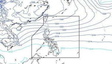
As of 7 a.m., Gener was spotted 315 kilometers (km) east northeast of Casiguran, Aurora, moving west northwestward at 10 km per hour (kph). It packs maximum sustained winds of 45 kph near the center, with gusts of up to 55 kph. Strong winds extend outward up to 360 km from the center.
Here are the areas where Tropical Cyclone Wind Signal No. 1 is in effect:
- Mainland Cagayan (Eastern and Central Portions): Piat, Santo Niño, Camalaniugan, Tuao, Lal-Lo, Enrile, Gonzaga, Alcala, Amulung, Santa Teresita, Baggao, Buguey, Solana, Rizal, Santa Ana, Tuguegarao City, Gattaran, Peñablanca, Iguig, Lasam, Aparri, Ballesteros, Allacapan, Abulug
- Isabela
- Quirino
- Nueva Vizcaya (Eastern Portion): Alfonso Castaneda, Kasibu, Dupax del Norte, Quezon, Diadi, Bayombong, Ambaguio, Bagabag, Villaverde, Aritao, Bambang, Dupax del Sur, Solano
- Apayao (Eastern and Southern Portions): Conner, Flora, Pudtol, Santa Marcela, Luna, Kabugao
- Kalinga
- Mountain Province (Eastern and Central Portions): Paracelis, Sadanga, Bontoc, Natonin, Sabangan, Barlig
- Ifugao
- Aurora
- Nueva Ecija (Eastern Portion): Carranglan, Pantabangan, Bongabon, Gabaldon, Laur, General Tinio, Rizal, General Mamerto Natividad, Palayan City
- Mainland Quezon (Northern Portion): General Nakar, Infanta, Real
- Polillo Islands
These areas may experience strong winds with speeds ranging from 39 to 61 km/h, and minimal to minor impacts on life and property is expected.
Rainfall outlook
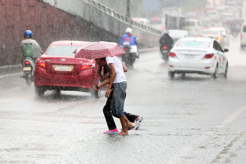
Heavy to intense rainfall is anticipated in various parts of Northern Luzon, particularly in Cagayan, Isabela and Aurora where 100 to 200 millimeters (mm) of rain is expected today, September 16.
Cagayan Valley, Cordillera Administrative Region and the northern part of Aurora may anticipate moderate to heavy rains where 50 to 100 mm of rain is expected.
Coastal waters, sea condition
A gale warning is also in effect, which covers the western and southern seaboards of Southern Luzon, the seaboards of Visayas and the western, northern and eastern seaboards of Mindanao.
PAGASA said that moderate to rough seas, ranging from 1.5 to 3.5 meters in height, will be prevalent across the seaboards of Northern and Central Luzon, as well as the eastern seaboards of Southern Luzon.
Other coastal areas of the country not covered by the gale warning will also experience moderate seas, with wave heights reaching up to 2.5 meters.
The state weather agency said mariners operating smaller vessels are encouraged to exercise extreme caution and, if possible, avoid sea navigation during this period.
Track forecast
Gener is projected to continue its west to west southwest trajectory until Wednesday afternoon, September 18, before shifting west-northwestward.
According to PAGASA, the tropical depression is expected to make landfall in either Isabela or Aurora within the next 24 hours.
Gener is forecast to exit the Philippine area of responsibility (PAR) by Wednesday. It is also forecast to move toward Hainan, China, where it may make landfall between late Friday evening and early Saturday morning.


- Latest
- Trending