Todays Weather
September 2, 2003 | 12:00am
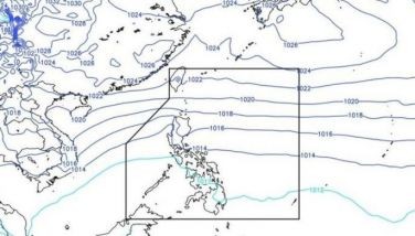
Typhoon ‘Onyok’ has maintained its strength as it slowed down while approaching the Batanes group of islands.
This weather disturbance is expected to induce the southwest monsoon and bring rains over the country especially the western sections. Residents in low-lying areas and near mountain slopes are advised to be alert against flash floods and landslides.
At 4 p.m. yesterday, the eye of Typhoon ‘Onyok’ was located based on satellite and surface data at 150 kilometers east-northeast of Basco, Batanes with strongest sustained winds of 150 kilometers per hour near the center and gustiness up to 185 kilometers per hour. It is moving west at 24 kilometers per hour.
Typhoon ‘Onyok’ is forecast to be at 380 kilometers west-northwest of Basco, Batanes or at 430 kilometers east-southeast of Hong Kong by this afternoon and will be at 130 kilometers west-southwest of Hong Kong by tomorrow afternoon.
Public Storm Warning Signal No. 3 remains in effect over the Batanes group of islands including Babuyan and Calayan Islands while Public Storm Warning Signal No. 2 is in effect over Cagayan, Apayao and Ilocos Norte. These areas will experience stormy weather and coastal waters will be rough to very rough and dangerous to all types of seacrafts.
Public Storm Warning Signal No. 1 remains in effect over the rest of Northern Luzon including Northern Aurora.
| Temperature Forecast | Low | High |
| Metro Manila | 24° | 31° |
| Baguio City | 17° | 24° |
| Tagaytay City | 22° | 31° |
| Subic | 24° | 31° |
| Clark Zone & Lahar Areas | 24° | 31° |
| Metro Cebu | 23° | 31° |
| Metro Davao | 23° | 31° |
| Cagayan De Oro | 24° | 32° |
| Tidal Predictions along Manila Bay: |
| High tide at 1:35 a.m. at 0.99 meter, and at 2:45 p.m. at 0.73 meter |
| Low tide at 8:35 a.m. at —0.34 meter, and at 7:22 p.m. at -0.54 meter |
| Sunrise: 5:44 A.M. |
| Sunset : 6:08 P.M. |
BrandSpace Articles
<
>
- Latest
- Trending
Trending
Latest
Trending
Latest
Recommended


