Deadly quake turns seabed into shore
MANILA, Philippines — Arsenio Butil Jr. fell to his knees and began to pray when last week’s magnitude 7.8 earthquake began shaking his home on the coast of Sarangani.
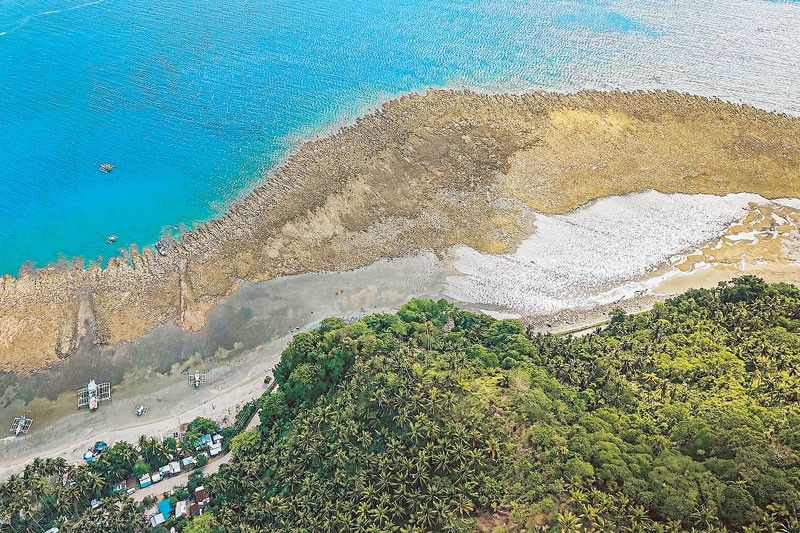
When he opened his eyes, he saw a once-familiar shoreline changing in real time, with swathes of previously submerged coral suddenly pushing above the waterline.
The June 8 quake, driven by a shifting of the nearby Cotabato Trench, toppled buildings, triggered landslides and killed at least 76 people.
The tectonic forces at work also thrust chunks of the island’s coastline upward in a phenomenon known as “coastal uplift,” leaving stretches of shore unrecognizable to families who have spent their whole lives there.
During a visit to the area, AFP saw fishing boats that had once been at the water’s edge on the wrong side of a wall of jagged, now-dead coral stretching for kilometers in both directions.
Butil, a fisherman and pastor living in Sarangani province’s Glan, told AFP the June 8 quake was the largest that he had ever felt.
“What I saw at the shoreline was that the water receded. After a while, I saw it... slowly returning. And then it receded again. Maybe three or four times,” Butil said.
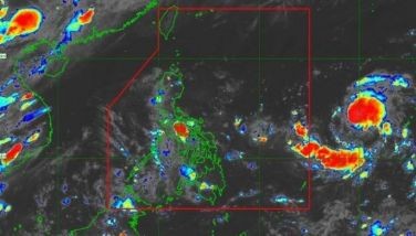
The Cotabato Trench, which lies as close as 50 kilometers off Mindanao, is the site of frequent seismic activity, including a “swarm” of thousands of mostly small tremors recorded in January.
A UN disaster risk reduction report released in mid-May hinted they could be a precursor to a large earthquake.
“What they see now is their new coastline,” Nane Danlag of the Philippines’ seismology center told AFP from her office in General Santos City on Friday, adding the change was permanent.
“The (seabed) went up two meters,” Danlag said, extending the shore by 200 meters in some areas according to initial assessments.
Pointing at a map, she said the affected area stretched between two towns nearly 100 kilometers apart.
As shocking as the changes to the coastline appeared, the shifting of the Earth’s crust that created it was a “natural movement,” she said.
“This has been going on for thousands of years.”
What everyone fears
In the hills above a neighboring village, about 100 men, women and children who fled to higher ground when the earthquake struck were still living in an encampment visited by AFP.
Datu Atom Malimpnig, a Maguindanaon chieftain, said the newly formed coastline had left the group of fishermen and their families hesitant to return to their now-destroyed homes.
Many remain convinced a tsunami could yet strike, he said, as government aid workers ladled rice porridge into bowls for the evacuees.
“(The seabed) rose... It’s not the same as it was before,” Malimpnig said.
“What if the sea surges forward? That is what everyone fears,” he said, adding their new home atop the hill felt far safer.


- Latest
- Trending