


Verbena makes landfall in Surigao del Sur
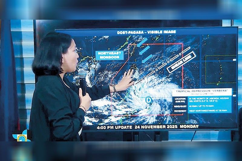
MANILA, Philippines — Tropical Depression Verbena made landfall over Bayabas, Surigao del Sur at 1:30 p.m. yesterday and later crossed into Agusan del Norte, the Philippine Atmospheric, Geophysical and Astronomical Services Administration (PAGASA) reported.
As of 4 p.m. yesterday, the weather system’s center was located near Jabonga, Agusan del Norte, moving west-northwest at 30 kilometers per hour. It carried maximum sustained winds of 45 kph and gusts of up to 75 kph.
PAGASA has raised Tropical Cyclone Wind Signal No. 1 across multiple areas nationwide, signaling strong winds of 39 to 61 kph that could cause light to minor damage.
In Luzon, areas under Wind Signal 1 are Occidental Mindoro, Oriental Mindoro, Romblon, northern and central Palawan (Araceli, Taytay, El Nido, Dumaran, Roxas, San Vicente, Puerto Princesa City), including Calamian, Cuyo, and Cagayancillo Islands; mainland Masbate (Balud, Mandaon, Milagros, Cawayan, Placer, Pio V. Corpuz, Esperanza, Uson, Masbate City, Mobo, Palanas, Aroroy, Cataingan, Baleno).
Areas covered in the Visayas include Antique, Aklan, Capiz, Iloilo, Guimaras, Negros Occidental, Negros Oriental, Siquijor, Cebu, Bohol, Samar, Eastern Samar, Biliran, Leyte, Southern Leyte.
While in Mindanao, Dinagat Islands, Surigao del Norte, Surigao del Sur, Agusan del Norte, Agusan del Sur, Camiguin, Misamis Oriental, northern Bukidnon (Baungon, Libona, Manolo Fortich, Sumilao, Impasug-ong, Malaybalay City, Malitbog, Cabanglasan), northern Misamis Occidental (Sapang Dalaga, Calamba, Baliangao, Plaridel, Lopez Jaena, Oroquieta City, Aloran, Panaon, Jimenez, Concepcion), northern Zamboanga del Norte (Jose Dalman, Manukan, Pres. Manuel A. Roxas, Katipunan, Dipolog City, Polanco, Piñan, Dapitan City, La Libertad, Sibutad, Rizal, Mutia) are under the storm signal.
PAGASA said heavy rainfall, gusty winds and rough seas are expected even outside TCWS areas due to the combined effects of Verbena and the northeast monsoon.
A gale warning is in effect for the northern seaboard of Northern Luzon, where coastal waters may reach 4.5 meters.
Mariners, particularly operators of small vessels, are advised to stay in port or seek shelter.
Verbena is forecast to continue moving across the Caraga region through early evening, then accelerate across the Visayas and northern Palawan before emerging over the West Philippine Sea by Wednesday morning.
It may slightly intensify and could reach tropical storm strength near northern Palawan or over the West Philippine Sea, potentially peaking as a severe tropical storm north of the Kalayaan Islands. — Evelyn Macairan, Gilbert Bayoran, Gerry Lee Gorit


- Latest
- Trending


