PAGASA: LPA outside PAR has 'medium' chance of becoming tropical depression
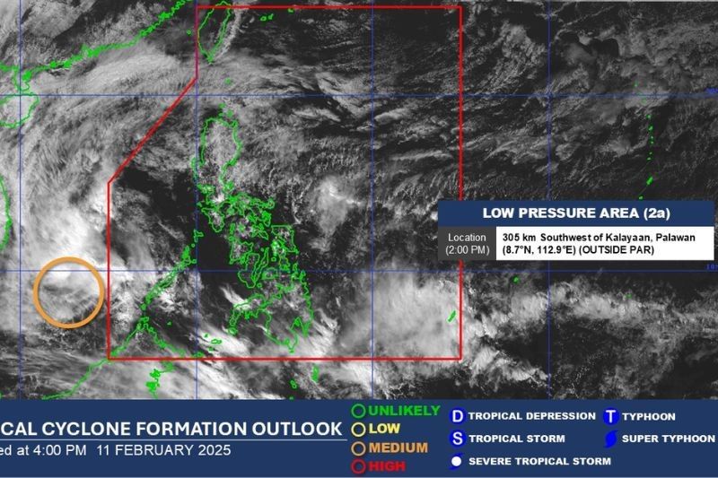
MANILA, Philippines — State weather bureau PAGASA is currently monitoring a low-pressure area (LPA) outside the Philippine Area of Responsibility that shows a medium chance of intensifying into a tropical depression within the next 24 hours.
The weather disturbance was observed at 2:00 p.m. on Tuesday, February 11, according to the state weather bureau's advisory.
The LPA was spotted some 305 kilometers southwest of Kalayaan, Palawan.
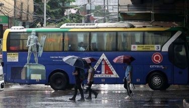
For days, residents of Puerto Princesa City and other parts of Palawan have faced severe flooding with chest-deep waters as torrential rains from the shear line and intertropical convergence zone continue to pound the province. Pictures and videos circulating online show widespread flooding across multiple areas including the capital city.
Meanwhile, in a different weather advisory, PAGASA warned of moderate to heavy rainfall (50-100 mm) in several provinces due to a shear line.
From today until tomorrow afternoon, the affected areas include Cagayan, Isabela, Aurora and Quezon.
The rainfall is expected to persist from tomorrow afternoon through Thursday afternoon (February 13), particularly affecting Cagayan, Isabela and Aurora provinces.
PAGASA cautions that rainfall may be higher in mountainous and elevated areas, with some regions potentially experiencing worse impacts due to significant previous rainfall. The weather bureau has advised the public and disaster risk reduction and management offices to take necessary precautionary measures to protect life and property.
The next weather advisory will be issued by the bureau at 11:00 p.m. on Tuesday.


- Latest
- Trending