'Enteng' exits PAR; rains to persist across Luzon
MANILA, Philippines (Updated 9:34 a.m.) — State weather bureau PAGASA said Severe Tropical Storm Enteng exited the Philippine Area of Responsibility but some areas in Luzon are still expected to experience monsoon rains.
Enteng, which has slightly intensified, left PAR as of 4:00 a.m. on Wednesday, September 4.
According to PAGASA's 5 a.m. bulletin, Enteng was spotted 265 kilometers west-northwest of Laoag City, Ilocos Norte.
Moving west-northwestward at a slow pace, Enteng was carrying peak winds of 100 kilometers per hour (kph) and gusts reaching up to 125 kph.
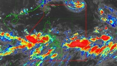
Rainfall, severe winds
Expected rainfall on Wednesday is between 50 and 100 millimeters in Ilocos Norte and Ilocos Sur.
Elevated and mountainous areas may experience higher rainfall, increasing the risk of flooding and landslides, especially in locations already susceptible to these hazards.
The southwest monsoon is expected to bring significant rainfall over the coming days to the following areas:
Wednesday, September 4
- Heavy to intense rainfall (100 to 200 millimeters): Pangasinan, Zambales, Bataan, and Occidental Mindoro.
- Moderate to heavy rains (50 to 100 millimeters): Northern Palawan, including Calamian, Cuyo, and Cagayancillo Islands, as well as Metro Manila, Cavite, Batangas, Rizal, Laguna, Bulacan, Pampanga, Tarlac, Nueva Ecija, La Union, and Benguet
Thursday, September 5
- Heavy to intense rainfall (100 to 200 millimeters): Pangasinan, Zambales, Bataan and Occidental Mindoro
- Moderate to heavy rains (50 to 100 millimeters): Northern Palawan, including Calamian, Cuyo, and Cagayancillo Islands, along with Metro Manila, Cavite, Batangas, Rizal, Laguna, Bulacan, Pampanga, Tarlac, and Nueva Ecija
Friday, September 6
- Moderate to heavy rains (50 to 100 millimeters): Occidental Mindoro, Zambales, and Bataan.
Forecast track
Enteng is expected to continue moving generally westward until September 5, after which it will shift to a west-northwest trajectory.
The storm is anticipated to intensify and could reach typhoon status within the next 12 hours, according to PAGASA.
Enteng is projected to make landfall in southern mainland China over the weekend.


- Latest
- Trending