‘Carina’ out of PAR; monsoon rains linger
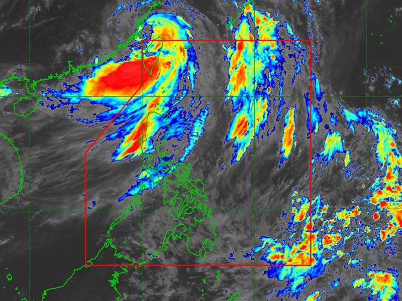
MANILA, Philippines — Typhoon Carina (international name: Gaemi), now weakened, exited the Philippine Area of Responsibility (PAR) late Thursday morning, according to the state weather bureau PAGASA.
In its 11 a.m. bulletin, PAGASA reported that Carina was located 515 kilometers north-northwest of Itbayat, Batanes, moving west-northwestward at 20 kilometers per hour (kph).
The typhoon is expected to make its final landfall in southeastern China on Thursday afternoon or evening as it continues to weaken.
Carina had sustained winds of 140 kph near the center, with gusts of up to 215 kph and a central pressure of 965 hPa.
Tropical Cyclone Wind Signal No. 1 is still hoisted over Batanes, where wind speeds range from 39 kph to 61 kph. PAGASA warned that these winds could pose a minimal to minor threat to life and property.
Severe winds
The southwest monsoon, locally known as habagat, which is enhanced by Carina, is expected to bring strong to gale-force gusts over coastal and upland areas.
The anticipated areas to be impacted are the following:
- Thursday and Friday: Batanes, Babuyan Islands, Ilocos Region, Cordillera Administrative Region, Nueva Vizcaya, Quirino, the eastern portion of Isabela, Central Luzon, Metro Manila, CALABARZON, MIMAROPA, Bicol Region, Western Visayas, Negros Occidental and Northern Samar
- Saturday: Batanes, Ilocos Region, Zambales, Bataan, Marinduque, Romblon and Kalayaan Islands.
Rainfall
PAGASA said that Carina is less likely to bring rain on the Philippine landmass in its weakened state.
However, the enhanced southwest monsoon will still bring heavy to intense rainfall over the Ilocos Region, Zambales and Benguet on Thursday, with moderate to heavy rainfall expected in various localities in the western parts of Luzon from Thursday to Saturday.
Hazards on coastal waters
A gale warning has been issued by PAGASA for the coastal waters of Batanes, Babuyan Islands, Ilocos Norte, Ilocos Sur and northwestern Cagayan, indicating that sea travel is hazardous for small seacrafts.
In the next 24 hours, Carina and the intensified habagat will cause rough seas along the western seaboard of Central Luzon.
Moderate to rough seas are also anticipated along the northern and western coastlines of northern Luzon beyond areas covered by gale warnings, as well as the western coast of southern Luzon and the eastern coast of northern Luzon.
Small seacraft operators, such as motorbancas, are strongly cautioned by the state weather bureau against navigating these seas, particularly if they lack experience or are using inadequately equipped vessels.


- Latest
- Trending