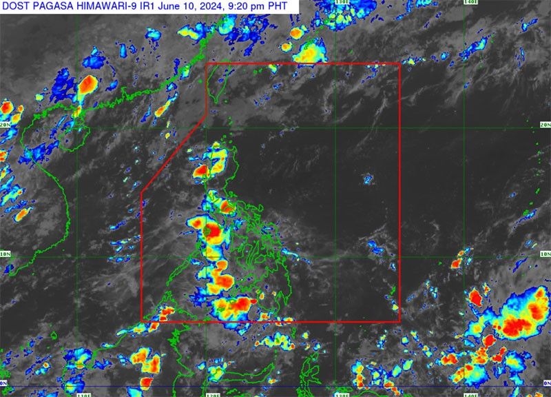
LPA spotted in Mindanao

MANILA, Philippines — A low-pressure area (LPA) was spotted in Mindanao yesterday afternoon, according to the Philippine Atmospheric, Geophysical and Astronomical Services Administration.
PAGASA weather specialist Veronica Torres said the cloud clusters being monitored east of Mindanao have developed into an LPA.
“As of 3 p.m. today (Monday), the LPA was monitored 135 kilometers east of Butuan City, Agusan del Norte,” Torres said.
She said the weather bureau does not expect the LPA to become a tropical cyclone in the next 24 to 48 hours. “There is still a low possibility that the LPA will develop into a typhoon in the next 24 to 48 hours. However, the LPA will still bring rains,” she added.
Torres said the LPA will affect the Visayas, Zamboanga peninsula, Northern Mindanao, Dinagat Islands, Surigao del Norte, Surigao del Sur and Agusan del Norte.
She warned of possible flash floods or landslides due to moderate to at times heavy rains.
According to Torres, Metro Manila and the rest of the country will experience partly cloudy to cloudy skies with isolated rainshowers or thunderstorms.
The weather bureau has said that at least one to two cyclones are expected for the month of June.
PAGASA said that El Niño has ended, adding that there is a 69 percent chance of transitioning from El Niño Southern Oscillation-neutral (an occurrence which is neither El Niño or La Niña) to La Niña by the third quarter of 2024. — Artemio Dumlao
- Latest
- Trending


