


‘Aghon’ intensifies into severe tropical storm; Signal No. 3 raised in eastern Quezon
MANILA, Philippines — The eastern section of Quezon province was placed under Wind Signal No. 3 as cyclone Aghon (Ewiniar) intensified into a severe tropical storm on Sunday afternoon.
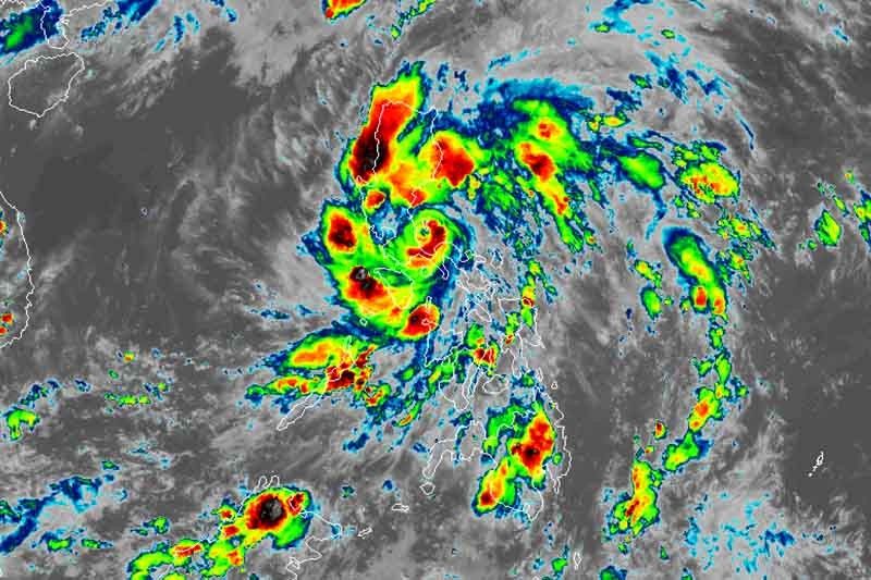
PAGASA said Aghon, the country’s first cyclone this year, was last seen over the coastal waters of Mauban in Quezon province, with peak winds of 95 kilometers per hour near the center and gusts of up to 130 kph.
The severe tropical storm was slowly moving northeast towards the Polillo Islands.
PAGASA raised wind signals over the following areas:
Signal No. 3 (Winds between 89 kph to 117 kph may be expected in at least 18 hours)
- Eastern section of Quezon (Infanta, Real, Mauban) including Polillo Islands (Panukulan, Burdeos, Patnanungan, and Polillo)
Residents of areas under Signal No. 3 could experience moderate to significant impacts from strong winds.
Signal No. 2 (Winds between 62 kph and 88 kph may be expected in at least 24 hours)
- Aurora
- Northern and central portions of Quezon (Alabat, Perez, Quezon, Gumaca, Lopez, Macalelon, General Luna, Unisan, Pitogo, Plaridel, Agdangan, Padre Burgos, Atimonan, General Nakar, Sampaloc, Pagbilao, Calauag, Lucban, City of Tayabas, Lucena City, Tiaong, Candelaria, Sariaya, Dolores, San Antonio, Jomalig)
- Laguna
- Eastern portion of Batangas (City of Tanauan, San Jose, Lipa City, Mataasnakahoy, Balete, Malvar, Santo Tomas, Cuenca, San Pascual, Batangas City, Ibaan, Padre Garcia, Rosario, San Juan, Taysan, Lobo)
- Eastern and central portions of Rizal (Jala-Jala, Pililla, Tanay, Cardona, Binangonan, Morong, Baras, Rodriguez, City of Antipolo, Teresa)
- Northern portion of Camarines Norte (Santa Elena, Capalonga)
Residents of areas under Signal No. 2 could experience minor to moderate impacts from strong winds.
Signal No. 1 (Winds between 39 and 61 kph may be expected in at least 36 hours or intermittent rains may be expected within 36 hours)
- Eastern portion of Isabela (Divilacan, San Mariano, San Guillermo, Jones, Echague, San Agustin, Ilagan City, Benito Soliven, City of Cauayan, Maconacon, Angadanan, Naguilian, Palanan, Dinapigue)
- Eastern portion of Quirino (Maddela, Nagtipunan, Aglipay)
- Southern portion of Nueva Vizcaya (Alfonso Castaneda, Dupax del Sur, Dupax del Norte)
- Eastern and southern portions of Nueva Ecija (General Tinio, Gabaldon, Bongabon, Pantabangan, Rizal, General Mamerto Natividad, Laur, Palayan City, Peñaranda, San Leonardo, City of Gapan, Cabanatuan City, Santa Rosa, San Isidro, Cabiao, San Antonio, Jaen, Zaragoza, Aliaga, Talavera, Llanera)
- Southern portion of Bataan (Orani, Samal, City of Balanga, Abucay, Pilar, Orion, Limay, Mariveles, Bagac)
- Eastern portion of Pampanga (Candaba, San Luis, San Simon, Apalit, Santa Ana, Arayat, Mexico, Santa Rita, Guagua, Sasmuan, Macabebe, Masantol, Santo Tomas, Minalin, City of San Fernando, Bacolor, Lubao)
- Bulacan
- Metro Manila
- Rest of Quezon
- Rest of Rizal
- Rest of Batangas
- Northern and central portions of Oriental Mindoro (Pinamalayan, Pola, Naujan, Victoria, Socorro, City of Calapan, Bansud, Gloria, Baco, San Teodoro, Puerto Galera, Bongabong)
- Marinduque
- Extreme northern portion of Romblon (Concepcion, Corcuera, Banton)
- Rest of Camarines Norte
- Camarines Sur
Residents of areas under Signal No. 1 could experience minimal to minor impacts from strong winds.
More areas in Cagayan Valley and Central Luzon could be placed under Signal No. 1 in the next bulletin. PAGASA added that it is not ruling out the possibility of hoisting Signal No. 3 over the eastern section of Aurora.
“As Aghon continues to move across our country, I urge everyone in the affected areas to stay vigilant and prioritize your safety,” President Ferdinand Marcos Jr. said on X, adding that he has ordered local government units and emergency services to monitor the situation and provide assistance.
What to expect
PAGASA said that Aghon could bring rain of up to 200 millimeters over Quezon province, and between 100 and 200 mm over Aurora, eastern portion of Bulacan, Rizal, Laguna, Metro Manila and Camarines Norte until Monday afternoon.
Meanwhile, the eastern portion of Isabela, Nueva Ecija, the rest of Bulacan, the eastern portion of Pampanga, Cavite, Batangas, Oriental Mindoro, Occidental Mindoro, Romblon, Burias Island, the western portion of Camarines Sur, Cuyo Islands, Aklan, and Antique could have 50 to 100 mm of rainfall.
The state weather bureau warned of higher rainfall in elevated or mountainous areas. This can lead to flooding and landslides, especially in areas susceptible to these hazards or places that have experienced recent heavy rain.
PAGASA also said that there is a “minimal to moderate” risk of storm surge over the exposed and low-lying coastal areas of Cagayan, Isabela, Central Luzon, Metro Manila, CALABARZON, Mindoro provinces, Marinduque, Romblon, Camarines Norte, Camarines Sur, and Burias Island within the next 24 hours.
Sea travel is risky for small seacrafts, including all motor bancas, over the coastal waters of Aurora, Marinduque and Quezon province, southern coastal waters of Batangas and northern coastal waters of Camarines Norte.
Aghon will also bring moderate to rough seas of 1.5 to 3.5 meters over the coastal waters along the northern and eastern seaboards of Luzon as well as the seaboard of Bicol region.
The National Disaster Risk Reduction and Managament Council reported four people injured in Albay and over 2,700 affected due to Aghon.
Aghon out by Wednesday
The state weather bureau said there is a chance Aghon could intensify into a typhoon while over the sea east of Quezon.
Starting Monday, Aghon will gradually accelerate northeastward while gaining strength. It may reach typhoon category by Monday afternoon, and may exit the Philippine Area of Responsibility on Wednesday.
Forecast position
- May 27, 2024 2:00 a.m. - 105 km east southeast of Baler, Aurora
- May 27, 2024 2:00 p.m. - 140 km east northeast of Casiguran, Aurora
- May 28, 2024 2:00 a.m. - 300 km east of Tuguegarao City, Cagayan
- May 28, 2024 2:00 p.m. - 490 km east of Basco, Batanes
- May 29, 2024 2:00 a.m. - 705 km east northeast of Basco, Batanes
- May 29, 2024 2:00 p.m. - 1,060 km east northeast of Extreme Northern Luzon
- May 30, 2024 2:00 p.m. - 1,615 km east northeast of Extreme Northern Luzon (outside PAR)


- Latest
- Trending


