


PAGASA: ‘Kabayan’ weakens into LPA, but re-development into cyclone possible
MANILA, Philippines — Cyclone Kabayan weakened into a low pressure area Monday afternoon, but PAGASA warned it could re-develop into a tropical depression if environmental conditions improve slightly.
Kabayan dissipated into a remnant low at around 2:30 p.m., just hours after it made landfall in Davao Oriental.
According to PAGASA, the LPA was last spotted in the vicinity of Impasugong in Bukidnon. It was heading west at 25 kilometers per hour.
Despite the development, the LPA is expected to bring heavy rain to parts of Visayas and Mindanao until Tuesday afternoon.
Accumulated rainfall between 100 and 200 millimeters
- Surigao del Sur
- Surigao del Norte
- Dinagat Islands
- Agusan del Sur
- Davao del Norte
- Davao de Oro
- Davao Oriental
Accumulated rainfall between 50 and 100 mm
- Central Visayas
- Biliran
- Leyte
- Southern Leyte
- Zamboanga del Norte
- Northern Mindanao
- Davao City
- Cotabato
- Lanao del Sur
- Southern portions of Samar and Eastern Samar
- Rest of Caraga, Davao Oriental, Davao de Oro and Davao del Norte
In addition, the shear line, or the weather system formed when cold and warm winds converge, may dump heavy rain to the eastern portion of southern Luzon.
The surge of northeast monsoon or amihan will also bring gusty conditions to most of Luzon and Visayas for the next two days.
Re-development possible
PAGASA said the LPA will continue to cross the rugged terrain of Mindanao, and emerge over the Sulu Sea between this afternoon and evening.
“Afterwards, a slight improvement in the environmental conditions may allow this disturbance to reorganize and re-develop into a tropical depression,” the weather agency said.
Then, it will traverse the Sulu Sea south of Cagayancillo Islands.
“Kabayan is forecast to make another cross over central or southern Palawan by tomorrow morning or afternoon, then emerge over the West Philippine Sea shortly thereafter,” PAGASA said, adding it may pass near or over Kalayaan Islands between Tuesday evening and Wednesday morning.
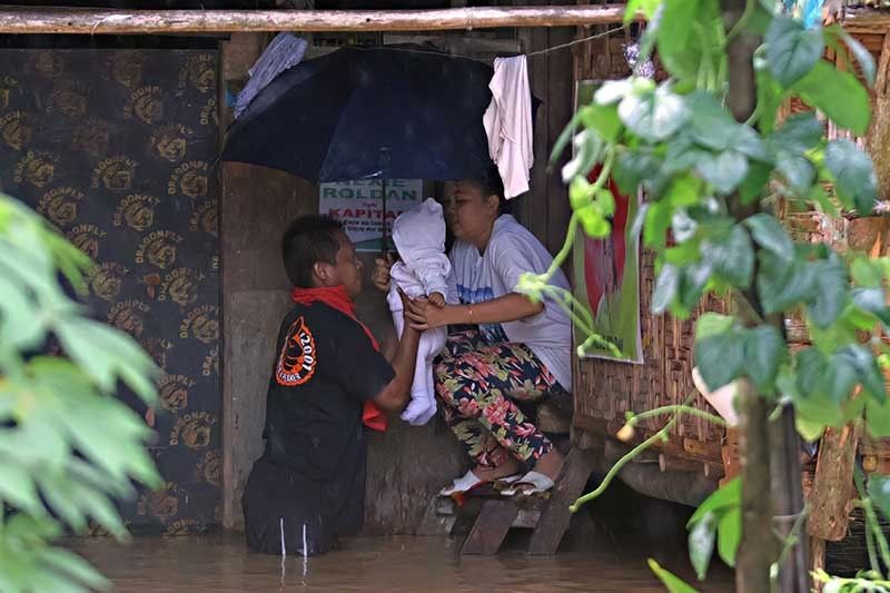
The National Disaster Risk Reduction and Management Council reported Monday that around 6,723 people have been displaced due to the effects of Kabayan and the shear line.
Around 11,729 people from Northern Mindanao and CARAGA were pre-emptively evacuated.
The Philippines has so far experienced fewer storms in 2023 than in any of the past 25 years. Only 11 have made landfall or come close so far this year. The archipelago is usually affected by around 20 cyclones a year.


- Latest
- Trending


