PAGASA: Typhoon Jenny steadily strengthens over Philippine Sea
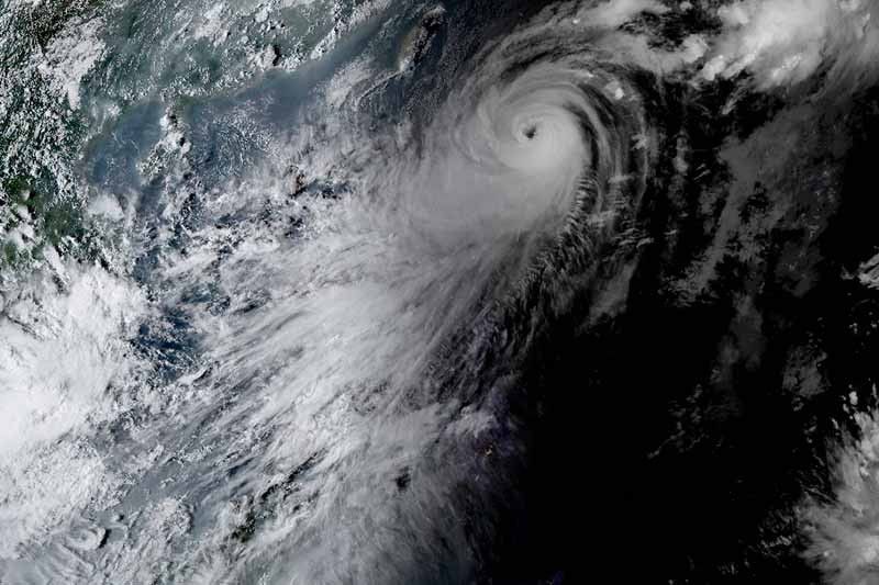
MANILA, Philippines — Typhoon Jenny (international name: Koinu) steadily gained strength Monday afternoon, and may reach its peak intensity Tuesday, according to state weather bureau PAGASA.
Jenny was last spotted 485 kilometers east of Basco in Batanes, with peak winds of 155 km per hour near the center and gusts of up to 190 kph. It is moving northwest at a speed to 15 kph.
PAGASA raised Wind Signal No. 1 over the following areas:
- Batanes
- Cagayan including Babuyan Islands
- Northern and eastern portion of Isabela (Maconacon, Divilacan, Palanan, Santa Maria, San Pablo, Tumauini, Cabagan, Ilagan City, San Mariano, Santo Tomas, Dinapigue, Benito Soliven, Naguilian, Gamu, Quirino, Delfin Albano, Quezon, Mallig)
- Apayao
- Northern and central portion of Ilocos Norte (Carasi, Vintar, Burgos, Dumalneg, Bangui, Pagudpud, Adams, Nueva Era, Pasuquin, Bacarra, Laoag City, San Nicolas, Sarrat, Piddig, Dingras, Solsona, Marcos)
- Northeastern portion of Abra (Tineg, Lacub, Malibcong)
- Northern portion of Kalinga (Balbalan, Pinukpuk, Rizal, City of Tabuk)
Residents of these areas may experience minimal to minor impacts from strong winds.
What to expect
According to PAGASA, Signal No. 2 is the expected highest signal, but the possibility of Signal No. 3 cannot be ruled out at the moment.
Jenny will bring heavy rains of up to 100 millimeters to Batanes, Babuyan Islands, Ilocos Norte, Ilocos Sur, mainland Cagayan, and Isabela until Tuesday noon.
The typhoon will continue to enhance the southwest monsoon and stir occasional to monsoon rains over the western portions of Central Luzon, Southern Luzon, Visayas and Mindanao in the next three days.
The weather bureau warned of possible flooding and landslides, especially in areas identified as susceptible to these hazards, and in places that have received substantial rainfall over the past few days.
Most of MIMAROPA, Western Visayas and Bicol region will experience gusty conditions due to the enhanced southwest monsoon.
The typhoon is expected to make landfall over the southern portion of Taiwan Thursday morning. By Thursday afternoon, it will exit the Philippine Area of Responsibility.
Forecast position
- Oct 3, 2023 2:00 AM - 455 km east of Basco, Batanes
- Oct. 3, 2023 2:00 PM - 300 km east of Itbayat, Batanes
- Oct. 4, 2023 2:00 AM - 240 km east northeast of Itbayat, Batanes
- Oct. 4, 2023 2:00 PM - 190 km north northeast of Itbayat, Batanes
- Oct. 5, 2023 2:00 AM - 230 km north northwest of Itbayat, Batanes
- Oct. 5, 2023 2:00 PM - 315 km northwest of Itbayat, Batanes (outside PAR)
- Oct. 6, 2023 2:00 PM - 500 km west northwest of Itbayat, Batanes (outside PAR)
- Oct. 7, 2023 2:00 PM - 470 km west northwest of Itbayat, Batanes (outside PAR)
— Gaea Katreena Cabico


- Latest
- Trending