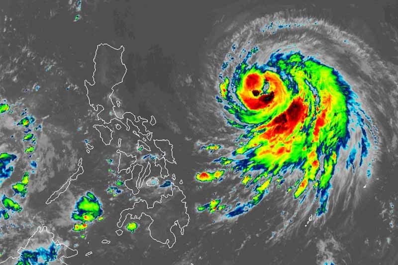
PAGASA: 'Chedeng' may become typhoon by Friday

MANILA, Philippines (Updated, 11:53 p.m.) — Severe Tropical Storm Chedeng (Guchol) may intensify into a typhoon Thursday evening or Friday, but it is still unlikely to directly bring heavy rain and severe winds, according to PAGASA.
Chedeng—the country’s third cyclone of the year—remains far from the land. It was last spotted 1,070 kilometers east of Central Luzon and moving west northwest at 15 kph.
It has peak winds of 100 km per hour near the center and gusts of up to 125 kph.
What to expect
Weather forecasters said that Chedeng is not expected to directly bring heavy rain in the next three to five days. It may, however, enhance the southwest monsoon (habagat), which may dump monsoon rain, especially in the western portion of the country.
The hoisting of wind signals is also unlikely, but the enhanced southwest monsoon may bring gusty conditions in the following areas Friday:
- Visayas
- Romblon
- Occidental Mindoro
- Northern part of Palawan including Kalayaan, Calamian and Cuyo Islands
- Surigao del Norte
- Dinagat Islands
- Camiguin
By Saturday, gusty winds from the enhanced southwest monsoon will affect these areas:
- Calabarzon
- Mimaropa
- Bicol region
- Camiguin
- Dinagat Islands
Forecast track
- June 8, 2023 08:00 PM - 960 km east of Central Luzon
- June 9, 2023 08:00 AM - 920 km east of Northern Luzon
- June 9, 2023 08:00 PM - 885 km east of Northern Luzon
- June 10, 2023 08:00 AM - 895 km east of Northern Luzon
- June 10, 2023 08:00 PM - 895 km east of Extreme Northern Luzon
- June 11, 2023 08:00 AM - 985 km east of Extreme Northern Luzon
- June 12, 2023 08:00 AM - 1,380 km east northeast of Extreme Northern Luzon (outside PAR)
- June 13, 2023 08:00 AM - 1,975 km east northeast of Extreme Northern Luzon (outside PAR)
— Gaea Katreena Cabico
- Latest
- Trending


