


‘Henry’ speeds up northward as it keeps strength
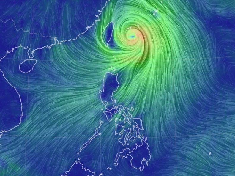
MANILA, Philippines — Typhoon Henry (international name: Hinnamnor) has accelerated as it moves northward away from Batanes and Babuyan islands while it keeps its strength, state weather bureau PAGASA says in its 11 a.m. bulletin.
Henry, which was last spotted 405 kilometers northeast of Itbayat, Batanes, is now moving northward at 15 kilometers per hour. It is packing winds of 150 kph near the center and gusts of up to 185 kph.
Signal No. 2 is still hoisted over Batanes, where winds between 61 kph to 120 kph may be expected in at least 24 hours.
Meanwhile, Signal No. 1 is up over Babuyan Islands and the northeastern portion of mainland Cagayan, where winds between 30 kph to 60 kph or intermittent rains are expected in at least 36 hours.
Henry is expected to bring moderate to heavy rains over Batanes and Babuyan, prompting PAGASA to warn of floods and landslides.
The typhoon is also forecast to enhance the southwest monsoon or habagat which will bring rain over the western sections of northern and central Luzon.
Strong to gale-force strength winds due to habagat and Henry may also be experienced especially in the coastal and mountainous areas over Ilocos region, Cordillera Administrative region, Central Luzon, Metro Manila, Calabarzon, Bicol region, Isabela, Nueva Vizcaya, Quirino, Mindoro provinces, Romblon and the remaining localities in mainland Cagayan.
A gale warning is in effect over the seaboards of northern Luzon and the eastern seaboard of Central Luzon.
Rough seas are expected over the eastern seaboard of southern Luzon in the next 24 hours, which may be risky for those using small seacrafts.
Henry is still not forecast to make landfall over any part of the Philippines, but PAGASA says it may pass very close or make landfall Saturday night over the southern islands of the Ryukyu archipelago in Japan.
The typhoon is expected to leave the Philippine Area of Responsibility on Saturday night, when it may slightly strengthen. — Xave Gregorio


- Latest
- Trending


