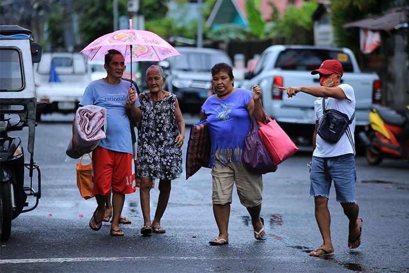
Thousands evacuated, stranded amid 'Quinta' onslaught

MANILA, Philippines (Updated 6:43 p.m.) — Days after Typhoon Quinta (international name Molave) made landfall, those reported to be evacuated, stranded, or even missing has skyrocketed to the thousands with the typhoon prompting state weather forecasters to hoist Tropical Cyclone Wind Signal no. 3 in some areas in Luzon.
According to the National Disaster Risk Reduction and Management Council's latest updates on Monday, 12 fisherfolk hailing from Brgy. Pananogan, Bato; Brgy. Cagdarao, Panganiban, Brgy. District 3, Gigmoto have been reported missing in Catanduanes.
"So far we have not received any info on deaths caused by Quinta. However, there were 12 people reported as missing in Catanduanes, [and] we are still looking into the details of this matter," NDRRMC spokesperson Mark Timbal told reporters in a text message.
From Calabarzon, Mimaropa, the Bicol Region and the Cordillera Region, a total of 2,475 families or 9,235 persons have been listed as affected by the typhoon according to their regional DRRMOs, Timbal disclosed, while 1,503 families amounting to 5,704 persons are staying in 33 evacuation centers located across the three regions.
With power interruptions also experienced in Quezon, Albay, Catanduanes, Cam Sur, Masbate and Sorsogon, some 3,524 persons or 968 families were also evacuated but opted to stay in other places outside the flood, landslide, storm-surge, and lahar-prone areas, usually with their other relatives.
Coast Guard deployed
Timbal added: "May lumubog po na vessel sa Bauan Batangas area; MV Oceanic Explorer 3 kanina 7 a.m. nagdeploy po na SAR team and PCG sub station sa Bauan at narescue po yung 7 na crew members pero hinahanap pa rin yung 8th hanggang sa ngayon."
(There was also a vessel that sunk in the Bayan Batangas area, the MV Oceanic Explorer 3, earlier at 7 a.m. The [coast guard] substation in Bauan has deployed a search and rescue team and already rescued seven crew members, but they are still looking for the eighth member until now.)
In a separate update sent to reporters, the Philippine Coast Guard confirmed that it was responding to at least three separate incidents at sea, namely:
- MV RoRo-12: "ran aground" due to weather, sea condition at Bonito Island, Tingloy, Maricaban, Batangas at 08:00 a.m.
- MV Oceanic Explorer 3: submerged 0.5 nautical miles off Keppel Shipyard, Barangay San Roque, Bauan, Batangas at 07:00 a.m.
- MTUG Super Shuttle 3: reported fire onboard at the waters of Shell Island, Cebu City at around 03:30 a.m. today. PCG successfully conducted a firefighting operation.
For its part, the PCG said that as of 4 a.m. Monday, a total of 1,839 stranded Filipinos had been recorded, including passengers, truck drivers, and cargo helpers; 929 rolling cargoes; 44 vessels; and 14 motorbancas stranded in Southern Tagalog, Bicol, Central Visayas, Western Visayas, and Eastern Visayas regions due to the typhoon.
125 vessels and 58 motorbancas are also taking shelter as a precautionary measure against possible threats of the tropical depression.
Police Gen. Camilo Cascolan, chief of the national police, also said Monday that the PNP has mobilized Police Regional Offices in areas along the projected path of Quinta to initiate proactive response measures in coordination with the Local Government Units and other concerned national and local agencies.
Later Monday, the PCG also recorded two more maritime incidents, this time involving the Supercat MV Saint Nuriel and Starlite Ferries MV Annapolies that both "ran aground due to rough sea condition" off Mabini, Batangas.
The crewmen rescued were brought to the Mabini Community Hospital in Batangas for further medical assistance.
Meanwhile, Rodolfo Sarabia, the eighth and final crew member missing from the MV Oceanic Explorer 3, has yet to be found as of Monday afternoon.
According to the NDRRMC, the 12 missing fishermen were still missing as of 4 p.m. as per the Bicol RDRRMC, and rescue operations are still being conducted by the PCG.
"The PCG Command Center has recorded a total of: 605 passengers, truck drivers, and cargo helpers; 20 vessels; 12 motorbancas; and 472 rolling cargoes stranded in Southern Tagalog, Bicol, Western Visayas, and Palawan," the PCG said in a separate release at 5 p.m.
"Moreover, 91 vessels and 67 motorbancas are taking shelter in said regions as a precautionary measure," it added.
As of 4 p.m., the NDRRMC also reported zero casualties so far per reports from its regional counterparts.
"In latest monitoring, (Typhoon) Quinta has affected 2,823 families in Calabarzon, Mimaropa, Bicol, and Cordillera Administration Region. 1,493 of which are currently staying in 68 evacuation centers while 968 are outside ECs," the council said for its part.
"11 flooding incidents were reported in Laguna, Camarines Sur, Negros Occidental, Samar, and Apayao. Seven landslide incidents also occurred in Laguna, Aklan, Samar, and Apayao."
Pagasa: Quinta maintains strength, now over Mindoro strait
In its latest severe weather bulletin issued 11 a.m., state weather bureau PAGASA said that Quinta was last seen 125 km north of Coron, Palawan or 120 km west southwest of Calapan City, Oriental Mindoro moving westward at 25 kph and packing peak winds of 125 kph near the center and gustiness of up to 150 kph.
"Quinta will continue to move westward until this afternoon, then will then turn west-northwestward towards the western boundary of the Philippine Area of Responsibility (PAR). "Quinta" is forecast to exit the PAR tomorrow morning," PAGASA also said.
The northwestern portion of Occidental Mindoro (Abra de Ilog, Mamburao, Paluan) including Lubang Island is under Tropical Cyclone Wind Signal No. 3.
Forecast positions
- Tuesday morning: 655 km West of Tanauan City, Batangas
- Wednesday morning: 1,110 km West of Central Luzon (Outside Philippine area of responsibility)
Follow this thread for updates on tropical cyclone Quinta.
Typhoon Quinta is forecast to exit the Philippine Area of Responsibility on Tuesday morning and is seen to intensfy over the West Philippine Sea and reach peak intensity in the next 24 hours, PAGASA says in its early morning bulletin on Tuesday.
The typhoon is expected to bring moderate to heavy rains over Western Visayas, Occidental Mindoro, Palawan including Calamian, Cuyo, and Kalayaan Islands, Aurora, Isabela, Cagayan.
Light to moderate with at times heavy rains over Zamboanga Peninsula, Bangsamoro, Northern Mindanao, Caraga, and the rest of Luzon and Visayas, PAGASA says.
Typhoon Quinta continues to intensify as it moves away from the Philippines, state weather bureau PAGASA says Monday night.
The typhoon is forecast to exit the Philippine Area of Responsibility Tuesday morning and reach its peak intensity within 24 hours.
At 10 p.m., Quinta was located 420 km west of Calapan City, Oriental Mindoro with maximum winds of 140 kph and gusts of 170 kph. It is moving westward at 25 kph.
Signal No. 1 is still hoisted over Lubang Island, Calamian Islands and Kalayaan Islands.
Typhoon Quinta slightly intensifies as it moves towards the western boundary of the West Philippine Sea.
It is forecast to reach its peak intensity in the next 24 hours but would exit the country Wednesday morning, state weather bureau PAGASA says.
At 4 p.m., Quinta was located 310 km west of Calapan City, Oriental Mindoro with maximum sustained winds of 130 kph near the center and gustiness of up to 160 kph.
'Quinta' was 125 kilometers north of Coron, Palawan as of 10 a.m., PAGASA says, or 120 km west southwest of Calapan City, Mindoro.
The typhoon is moving west at 25 km/h and has maximum sustained winds of 125 km/h near the center and gustiness of up to 150 km/h.
Tropical Cyclone Wind Signal No. 3:
Northwestern portion of Occidental Mindoro (Abra de Ilog, Mamburao, Paluan), including Lubang Island
TCWS No. 2 :
Oriental Mindoro
The rest of Occidental Mindoro
Calamian Islands
Batangas
Visayas
Extreme northern portion of Antique (Caluya)
TCWS No. 1:
- Southern portion of Zambales (San Antonio, Castillejos, Subic, Olongapo City)
- Bataan
- Southwestern portion of Pampanga (Floridablanca, Lubao, Sasmuan, Masantol)
- Southwestern portion of Bulacan (Hagonoy, Paombong, Malolos City, Bulacan, Obando, Meycauayan City)
- Metro Manila
- Rizal
- Cavite
- Laguna
- Quezon including Polillo Islands
- Marinduque
- Romblon
- Northern portion of Palawan (El Nido, Taytay), including Cuyo Islands
Visayas
- Aklan and the rest of the northern portion of Antique (Laua-An, Barbaza, Tibiao, Culasi, Sebaste, Pandan, Libertad)
'Quinta' made a fifth landfall over Pola, Oriental Mindoro early Monday morning as it traverses the island and is expected to emerge over the West Philippine Sea.
As of 4 a.m., 'Quinta' was in the vicinity of Socorro, Oriental Mindoro as of 4 a.m., according to an early morning PAGASA bulletin. The typhoon is moving west at 25 kilometers per hour and has maximum sustained winds of 125 km/h near the center and gustiness of up to 180 km/h.
Tropical Cyclone Wind Signal No. 3 is up over the following areas:
- The southern portion of Quezon (Mulanay, San Francisco, Catanauan, General Luna, Macalelon, Pitogo, Unisan, Agdangan, Padre Burgos, Pagbilao, Lucena City, Sariaya, Candelaria, Tiaong, San Antonio, Dolores, Tayabas City)
- Southern portion of Batangas (Lian, Tuy, San Juan, Rosario, Padre Garcia, Lipa City, Cuenca, San Jose, Ibaan, Taysan, Lobo, Batangas City, Mabini, Tingloy, San Pascual, Bauan, Alitagtag, San Luis, Taal, Santa Teresita, Calatagan, Balayan, Calaca, Lemery, Agoncillo, San Nicolas, Mataas Na Kahoy)
- Northern portion of Romblon (Concepcion, Banton, Corcuera, Romblon, San Agustin, Calatrava, San Andres, Odiongan, Santa Maria)
- Marinduque
- Northern and central portion of Oriental Mindoro (Oriental Mindoro (Mansalay, Roxas, Bongabong, Bansud, Gloria, Pinamalayan, Pola, Socorro, Victoria, Naujan, Calapan City, Baco, San Teodoro, Puerto Galera)
- Northern and central portion of Occidental Mindoro (San Jose, Rizal, Calintaan, Sablayan, Santa Cruz, Mamburao, Paluan, Abra de Ilog) including Lubang Island
Tropical Cyclone Wind Signal No. 2 areas:
- Camarines Norte
- Western portion of Camarines Sur (Siruma, Tinambac, Calabanga, Naga City, Pili, Bula, Balatan, Minalabac, Milaor, Bombon, Magarao, Canaman, Camaligan, Gainza, San Fernando, Pasacao, Pamplona, Cabusao, Libmanan, Sipocot, Lupi, Ragay, Del Gallego)
- Burias Island
- Rest of Quezon, including Polillo Islands
- Laguna
- Rest of Batangas
- Cavite, Rizal
- Metro Manila
- Southern portion of Bulacan (Norzagaray, Angat, San Rafael, Baliuag, Pulilan, Calumpit, Hagonoy, Paombong, Malolos City, Plaridel, Bustos, San Jose del Monte City, Santa Maria, Pandi, Guiguinto, Balagtas, Bulacan, Bocaue, Meycauayan City, Obando, Marilao)
- Southern portion of Pampanga (Lubao, Sasmuan, Macabebe, Masantol, Minalin, Apalit), Bataan
- Rest of Romblon
- Rest of Oriental Mindoro
- Rest of Occidental Mindoro, and Calamian Islands
Visayas
- Extreme northern portion of Antique (Caluya)
Tropical Cyclone Wind Signal No. 1 areas:
- Catanduanes
- Rest of Camarines Sur
- Albay
- Western portion of Sorsogon (Donsol, Pilar, Castilla, Sorsogon City, Casiguran, Juban, Magallanes, Bulan, Irosin)
- Northern portion of mainland Masbate (Uson, Mobo, Masbate City, Baleno, Aroroy, Balud, Mandaon, Milagros) including Ticao Island
- Southern portion of Aurora (Dingalan, San Luis)
- Southern portion of Nueva Ecija (Gabaldon, Laur, Palayan City, General Tinio, Cabanatuan City, Aliaga, Zaragoza, Jaen, San Antonio, Santa Rosa, Peñaranda, Gapan City, San Leonardo, San Isidro, Cabiao)
- Southern portion of Tarlac (La Paz, Tarlac City, San Jose, Concepcion, Capas, Bamban)
- Rest of Bulacan
- Rest of Pampanga
- Central and southern portion of Zambales (Iba, Botolan, Cabangan, San Felipe, San Narciso, San Antonio, San Marcelino, Castillejos, Subic, Olongapo City)
- Northern portion of Palawan (El Nido, Taytay) including Cuyo Islands
Visayas
- The rest of the northern portion of Antique (Laua-An, Barbaza, Tibiao, Culasi, Sebaste, Pandan, Libertad)
- Aklan
- Capiz
- Northern portion of Iloilo (Lemery, Sara, San Dionisio, Batad, Estancia, Carles, Balasan)
- Latest
- Trending


