'Tisoy' downgraded to severe tropical storm
MANILA, Philippines — State weather bureau PAGASA has downgraded "
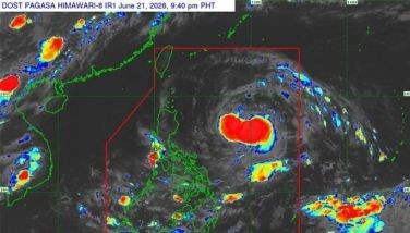
AT 4 a.m., "
The weather disturbance packs maximum winds of up to 100 kph and gusts of up to 125 kph. It is moving west-northwest at 20 kph.
Tropical Cyclone Wind Signals (TCWS) are still up in the following areas:
TCWS #2
- Southern Zambales (Castillejos, Olongapo City, San Antonio, San Felipe, San Marcelino, San Narciso, Subic)
- Bataan
- western Cavite (Alfonso, Gen. Emilio Aguinaldo, Magallanes, Maragondon, Ternate)
- western Batangas (Calaca, Balayan,
Tuy , Calatagan, Lian, Nasugbu) - northwestern Occidental Mindoro including Lubang Island (Abra de Ilog, Looc, Lubang, Mamburao, Paluan)
TCWS #1
- Metro Manila
- western Quezon (Dolores, Tiaong, Candelaria, Sariaya, San Antonio)
- Laguna
- Rizal
- rest of Batangas
- rest of Cavite
- Northern Palawan including Calamian Islands (El Nido, Coron, Busuanga, Culion, Linapacan)
southwestern Bulacan (Calumpit, Hagonoy, Paombong, Malolos City, Bulakan, Obando, Meycauayan City, Marilao, Bocaue, Balagtas, Guiguinto, Plaridel, Pulilan, Baliuag, Bustos, Pandi, Sta. Maria,San Jose Del Monte City)western Pampanga (Mabalacat City, Angeles City, Porac, Floridablanca, Lubao, Guagua, Sta. Rita, Bacolor, San Fernando City,Sto . Tomas, Minalin, Macabebe, Sasmuan, Masantol, Apalit, San Simon)- western Tarlac (Mayantoc, San Jose, Capas, Bamban)
- rest of Zambales
- Oriental Mindoro
- rest of Occidental Mindoro
Meanwhile, TCWS have
Ilocos Region, Cagayan Valley, Cordillera Administrative Region and Aurora will experience moderate with occasional heavy rains on Wednesday.
PAGASA advised residents in these areas, particularly those living in areas prone to flash floods and landslides, to take
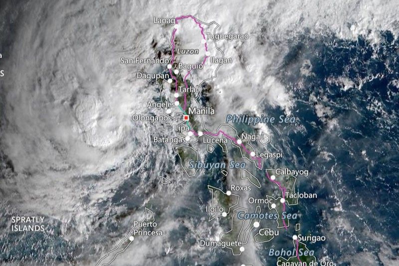
The state weather bureau also warned that sea travel is risky in areas under TCWS, the seaboards of Northern Luzon, eastern seaboard of Central Luzon and eastern and western seaboards of Southern Luzon.
The northeast monsoon or "
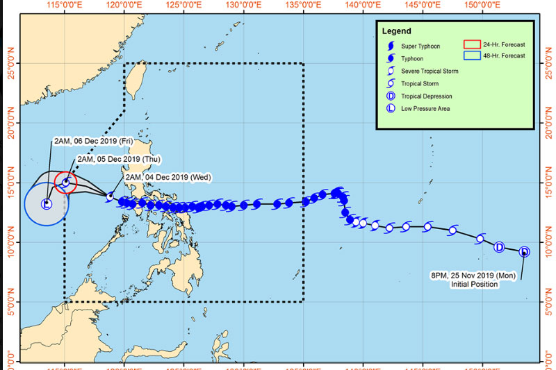
Forecast positions
• 24 hours (Thursday morning): 560 km west of Subic, Zambales
• 48 hours (Friday morning):830 km west of Calapan City, Oriental Mindoro (outside PAR)
— Patricia Lourdes Viray


- Latest
- Trending