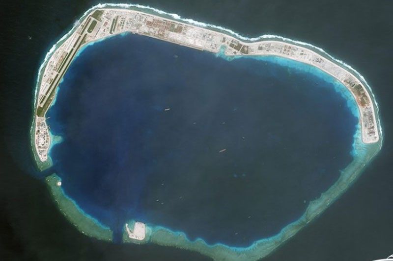
Satellite image shows China's aerostat at Mischief Reef

MANILA, Philippines — A Chinese aerostat was seen floating above Mischief Reef, one of Beijing's artificial islands in the disputed South China Sea.
ImageSat International posted a photo of the aerostat, which is probably used for military intelligence-gathering purposes.
"The use of #aerostat allows China a continuous situational awareness in this resource-rich region," ImageSat posted on Twitter.
For the first time, #China's aerostat, probably for #military #intelligence-gathering purposes, seen by #ISI at #Mischief Reef.
— ImageSat Intl. (@ImageSatIntl) November 24, 2019The use of #aerostat allows China a continuous situational awareness in this resource-rich region.#IMINT #VISINT #Space #SouthChinaSea #SouthSea pic. twitter.com/EnIzrJNht9
The satellite photo dated November 19 is the first evidence of an operational aerostat on Mischief Reef, according to ImageSat.
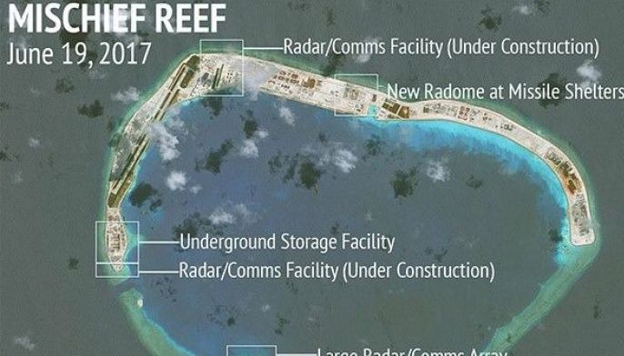
Mischief Reef, along with Fiery Cross and Subi Reefs, are China's "big three" islands in the Spratly group, which are also being claimed by the Philippines.
In July 2016, the United Nations-backed arbitral tribunal ruled that China interfered with the Philippines' exercise of sovereign rights over its exclusive economic zone.
Mischief Reef is part of the Philippines' continental shelf and is located within 200 nautical miles off the coast of Palawan.
Last year, China quietly deployed anti-ship cruise missiles and surface-to-air missiles on Fiery Cross, Mischief and Subi Reefs in the Spratly Islands in a move to dominate airspace control over the South China Sea, part of which is the West Philippine Sea.
- Latest
- Trending


