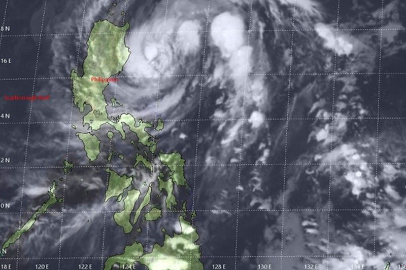
Tropical Storm Ramon makes landfall over North Luzon tonight

MANILA, Philippines — After lingering over the Philippine Sea in the past days, Tropical Storm Ramon was forecast to make landfall over Northern Luzon tonight or early tomorrow, the state weather bureau has warned.
The Philippine Atmospheric, Geophysical and Astronomical Services Administration (PAGASA), however, yesterday spotted a new weather disturbance over the Pacific, which may enter the country this week.
The slow-moving Ramon was expected to make landfall over the northeastern portion of Cagayan tonight or early tomorrow and cross the province of Apayao, according to PAGASA weather specialist Benison Estareja.
As of 4 a.m. yesterday, tropical cyclone wind signal No. 1 was hoisted over Cagayan, including Babuyan Island, Isabela and Northern Aurora, including the towns of Dilasag, Casiguran and Dinalungan.
These areas can expect gusty winds and heavy rains within the next 36 hours.
The center of Ramon was located at 285 kilometers east-northeast of Casiguran, Aurora, packing winds of 65 kilometers per hour near the center and gustiness of up to 80 kph.
It picked up speed yesterday and was moving west at 15 kph, from 10 kph earlier in the day.
Today, light to moderate with occasional heavy rains will prevail over Cagayan, Isabela, Apayao, Kalinga and Ilocos Norte.
Light to moderate rain with intermittent heavy rain will prevail over the Babuyan Group of Islands, Abra, Ifugao, Mountain Province, northern part of Aurora and Quirino.
Estareja said Ramon is likely to weaken into a tropical depression after pummeling provinces in Northern Luzon.
“By Wednesday morning, it is expected to cross Ilocos provinces and move over west of Dagupan, Pangasinan,” Estareja said.
It is forecast to weaken into a low-pressure area as it exits the country. It is expected to exit the Philippine area of responsibility on Thursday.
Meanwhile, the low-pressure area was spotted at 2,210 km east of Visayas as of 2 p.m.
PAGASA weather specialist Ana Clauren said the new low-pressure area is expected to intensify into a tropical cyclone after it enters the Philippine area of responsibility tomorrow.
The weather disturbance, which was felt on Wednesday in the Visayas and Luzon, failed to dump needed rains over the Angat watershed areas in Bulacan, and failed to stop the receding water level of Angat Dam in the last five days.
Based on the monitoring of the provincial disaster risk reduction management office of Bulacan, water elevation of Angat Dam on Wednesday was monitored at 188.45 meters but as of yesterday at 8 a.m., it had slid to 187.84 meters, still 24.16 meters short of its ideal end of year water level of 212 meters.
That 212-meter target level is only six weeks away, forcing the National Water Resources Board to reduce the water allocation for Metro Manila’s domestic water needs, forcing its two water concessionaires to implement rotational water service interruptions in its service areas. – With Ramon Lazaro
- Latest
- Trending


