Potential cyclone may enter Phl this week - PAGASA
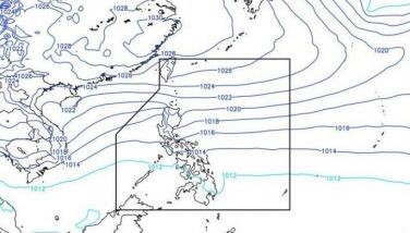
MANILA, Philippines - The state weather bureau is monitoring a new low pressure area (LPA) expected to enter the Philippine Area of Responsibility (PAR) early this week.
In an interview over radio dzMM, weather forecaster Jun Galang of the Philippine Atmospheric, Geophysical and Astronomical Services Administration (PAGASA) said the LPA may enter PAR by Tuesday afternoon or Wednesday morning.
The potential tropical cyclone may affect the regions of Eastern Visayas and Caraga if it enters the country.
It will then be named "Caloy," the third tropical cyclone to hit the Philippines this year.
According to PAGASA's 24-hour weather forecast, the northeast monsoon is still affecting Luzon, which will have partly cloudy to cloudy with isolated light rains.
The regions of Caraga and Northern Mindanao will experience cloudy skies with light rains and isolated thunderstorms.
PAGASA said the rest of the country will have partly cloudy to cloudy skies with isolated rainshowers or thunderstorms.
Moderate to strong winds from the northeast will prevail over Luzon, Eastern Visayas and Eastern Mindanao. The coastal waters along these areas will be moderate to rough.
Elsewhere, winds will be light to moderate blowing from the northeast with slight to moderate seas, the weather bureau added.
- Latest
- Trending


