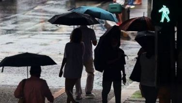
Signal No. 2 raised as 'Paolo' slightly intensifies

MANILA, Philippines — As Tropical Storm “Paolo” slightly intensifies over Philippine waters, PAGASA has placed parts of Isabela, Quirino and Aurora under Wind Signal No. 2.
In its 11 a.m. bulletin on Thursday, October 2, the state weather bureau last spotted Paolo inching its way towards northern Luzon, about 575 kilometers east of Infanta, Quezon.
The tropical storm is moving west northwestward at 20 kilometers per hour (kph), packing maximum sustained winds of 75 kph and gusts up to 90 kph.
Wind signals
Tropical Cyclone Wind Signals No. 1 and 2 now prevail over most of Luzon. No wind signals were raised in Visayas or Mindanao as of 11 a.m.
Signal No. 2 (gale-force winds in 24 hours)
- the southeastern portion of Isabela (San Mariano, Dinapigue, San Guillermo, Echague, Jones, San Agustin, Benito Soliven, Angadanan, City of Cauayan, Naguilian)
- the northern portion of Quirino (Maddela)
- the northern portion of Aurora (Dilasag, Casiguran, Dinalungan)
Signal No. 1 (strong winds in 36 hours)
- Cagayan
- the rest of Isabela
- the rest of Quirino
- Nueva Vizcaya
- Apayao
- Abra
- Kalinga
- Mountain Province
- Ifugao
- Benguet
- Ilocos Norte
- Ilocos Sur
- La Union
- Pangasinan
- the northern portion of Zambales (Palauig, Masinloc, Candelaria, Santa Cruz)
- Tarlac
- Nueva Ecija
- the rest of Aurora
- the northern portion of Bulacan (Doña Remedios Trinidad, San Miguel, San Ildefonso, Norzagaray, San Rafael)
- the northern portion of Pampanga (Magalang, Arayat, Candaba, Mabalacat City)
- the northern portion of Quezon (General Nakar, Infanta) including Polillo Islands
- the northern portion of Camarines Norte (Capalonga, Jose Panganiban, Paracale, Vinzons, Talisay, Daet, Mercedes, Basud)
- the northern portion of Camarines Sur (Siruma, Tinambac, Lagonoy, Garchitorena, Caramoan)
- and the northern portion of Catanduanes (Pandan, Bagamanoc, Panganiban, Viga, Caramoran)
Light to moderate damage is expected for high-risk and medium-risk structures under Signal No. 2, while light to no damage is projected for areas under Signal No. 1.
The state weather bureau also predicted heavy rains over some of these provinces starting Friday, October 3.
Sea conditions
PAGASA has warned provinces near coastal waters of rough to very rough seas reaching as high as 3 to 6 meters, mainly in Isabela, Cagayan, Aurora, Babuyan Islands, Polillo Islands, Catanduanes, Quezon, Camarines Norte and Camarines Sur.
Mariners are advised to seek shelter and avoid venturing out to sea under these conditions.
Forecast track
Paolo is anticipated to hit land over southern Isabela or northern Aurora on Friday morning as it continues to move west northwestward.
The tropical storm may intensify further into a severe tropical storm and raise Wind Signal No. 3.
The possibility of it reaching typhoon strength before landfall has not been ruled out, but current forecasts show a high chance of Paolo becoming a typhoon once it emerges over the West Philippine Sea.



- Latest
- Trending