


'Carina' now a tropical storm
MANILA, Philippines — Cyclone Carina reached the tropical storm category on Saturday afternoon, state weather bureau PAGASA reported.
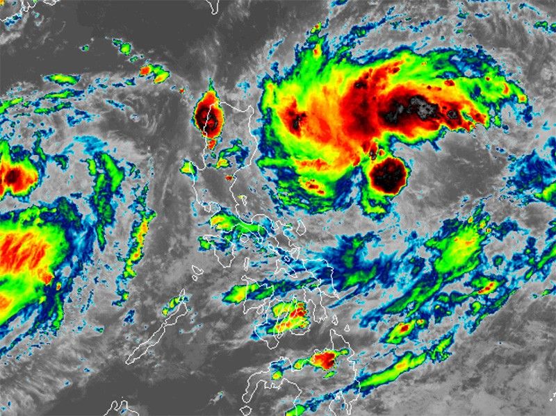
Carina’s peak winds increased to 65 kilometers per hour near the center and gusts to 180 kph as it moved west northwest at 15 kph. It was last seen 630 km east of Casiguran, Aurora.
While heavy rainfall directly caused by Carina is less likely over the next three days, PAGASA said the situation may evolve as forecasts change.
The southwest monsoon, enhanced by Carina and tropical depression (formerly Butchoy), is expected to bring moderate to heavy rains over western Luzon in the coming days.
Butchoy left the Philippine Area of Responsibility on Saturday morning.
Severe winds
Tropical Cyclone Wind Signal No. 1 may be raised over extreme northern Luzon and the eastern portion of Northern Luzon.
Carina and Tropical Depression Butchoy are expected to enhance the southwest monsoon or habagat, which will bring gusty conditions to the following areas:
- Saturday and Sunday: Kalayaan Islands
- Monday: CALABARZON, MIMAROPA, Bicol Region, Western Visayas, Zambales, Bataan and Metro Manila
Carina and the southwest monsoon will bring moderate seas (1.0-2.0 meters) along the eastern seaboard of the Philippines.
"Mariners of motor bancas and similarly-sized vessels are advised to take precautionary measures while venturing out to sea," PAGASA said.
Track outlook
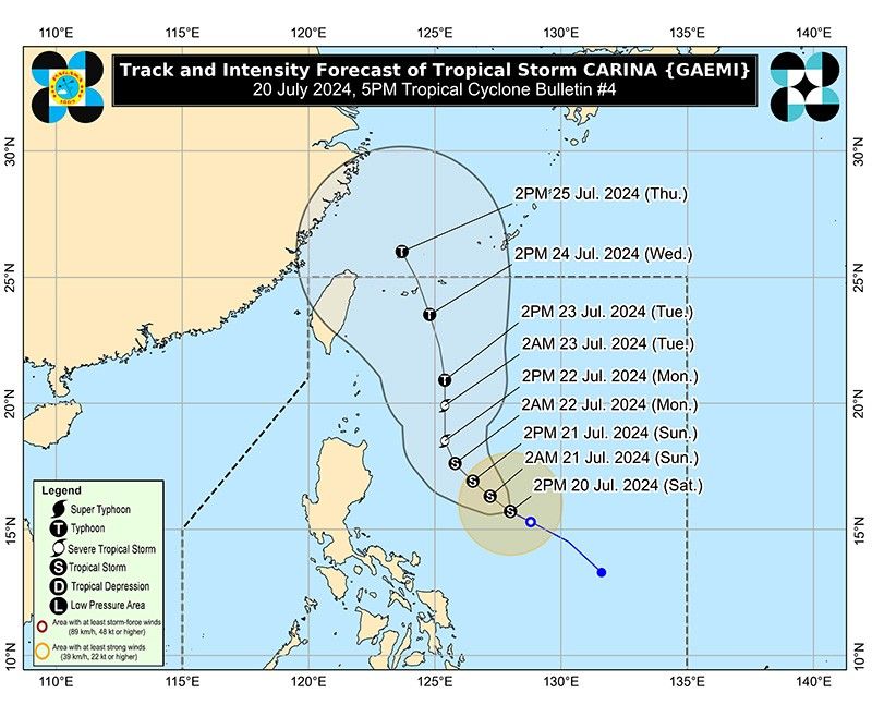
Carina is expected to move generally northwestward through Sunday, with a gradual slowdown in its pace, according to PAGASA.
By Monday, the tropical storm is projected to turn northward and then accelerate northward or north-northwestward over the Philippine Sea towards the Ryukyu archipelago starting Tuesday.
The storm is predicted to stay mostly offshore and not impact the Philippine landmass.
Carina is expected to intensify into a severe tropical storm by Monday and could become a typhoon by Tuesday.
Forecast position
- July 21, 2024 (Sunday) 2:00 a.m.: 540 km east of Casiguran, Aurora
- July 21, 2024 (Sunday) 2:00 p.m.: 470 km east of Casiguran, Aurora
- July 22, 2024 (Monday) 2:00 a.m.: 430 km east of Tuguegarao City, Cagayan
- July 22, 2024 (Monday) 2:00 p.m.: 400 km east of Aparri, Cagayan
- July 23, 2024 (Tuesday) 2:00 a.m.: 365 km east of Basco, Batanes
- July 23, 2024 (Tuesday) 2:00 p.m.: 370 km east of Itbayat, Batanes
- July 24, 2024 (Wednesday) 2:00 p.m.: 430 km northeast of Itbayat, Batanes
- July 25, 2024 (Thursday) 2:00 p.m.: 610 km north northeast of Itbayat, Batanes (outside PAR)


- Latest
- Trending


